Chiautla geodata
Chiautla (State of Mexico) is a populated place; located in Mexico in America/Mexico_City (GMT-6) time zone. With population of 9,839 people, there are 972 cities with bigger population in this country. Compared to other cities in Mexico, 53.1% of cities are located further ↑North; 52.3% of cities are located further ←West and 84.9% of cities have lower elevation than Chiautla. Note1


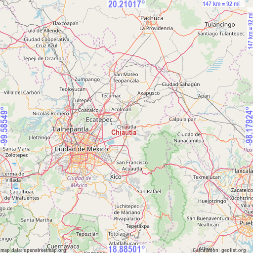
Chiautla GPS coordinates[2]
19° 32' 56.22" North, 98° 52' 56.496" West
| Map corner | latitude | longitude |
|---|---|---|
| Upper-left | 20.21017°, | -99.58549° |
| Center: | 19.54895°, | -98.88236° |
| Lower-right: | 18.88501°, | -98.17924° |
| Map W x H: | 147.3×147.3 km | = 91.5×91.5mi |
| max Lat: | 32.7° ⇑53.1% North |
| Chiautla: | 19.54895° |
| min Lat: | ⇓46.9% South 14.53588° |
| min Long | Chiautla | max Long |
| -117.105° | -98.88236° | -86.73105° |
| W 52.3%⇐ | ⇒47.7% E |
Elevation
Elevation of Chiautla is 2258 m = 7408 ft, and this is 1004.3 m = 3295 ft above average elevation for this country.
| Max E: |
3497 m = 11473 ft | 15.1% |
| Chiautla | 2258 m 7408 ft | |
| Avg. | 1253.7 m = 4113 ft | |
Min E: |
-1 m = -3 ft | 84.9% |
See also: Mexico elevation on elevation.city.
Geographical zone
Chiautla is located in North Torrid zone (between Equator and Tropic of Cancer). Distance of this Northern Tropic circle is 432.3 km =268.6 mi to North.| Distance of | km | miles | from Chiautla |
|---|---|---|---|
| North Pole | 7833.4 | 4867.4 | to North |
| Arctic Circle | 5227.5 | 3248.2 | to North |
| Tropic Cancer | 432.3 | 268.6 | to North |
| Equator | 2173.6 | 1350.6 | to South |


Nearby cities:
15 places around Chiautla: (largest is in red/bold)
• Atenguillo
1.7 km =1.1 mi,  20°
20°
• Chiconcuac
2.1 km =1.3 mi,  303°
303°
• Colonia Tulteca Teopan
4.2 km =2.6 mi,  70°
70°
• Ejido San Cristóbal
1.4 km =0.9 mi,  239°
239°
• La Pastoría
3.1 km =1.9 mi,  257°
257°
• Ocopulco
4.8 km =3 mi,  341°
341°
• Papalotla
3.1 km =1.9 mi,  59°
59°
• San Lucas Huitzilhuacán
4.2 km =2.6 mi,  358°
358°
• San Salvador Atenco
3.8 km =2.4 mi,  274°
274°
• Santiago Chimalpa (Chimalpa)
2.5 km =1.6 mi, 336°
• Tepetitlán
2.9 km =1.8 mi,  25°
25°
• Texcoco de Mora
4.1 km =2.5 mi,  180°
180°
• Tlaltecahuacán
3.3 km =2.1 mi,  3°
3°
• Tulantongo
2.1 km =1.3 mi,  157°
157°
• Zapotlán
2.2 km =1.4 mi, 263°
Sources, notices
• [Note1] Compared only with cities in Mexico existing in our database
• [Src1] Map data: © OpenStreetMap contributors (CC-BY-SA)
• [Src2] Other city data from geonames.org with taken over terms of usage.
• [Src3] Geographical zone / Annual Mean Temperature by Robert A. Rohde @ Wikipedia
