Mexcalcuautla geodata
Mexcalcuautla (Puebla) is a populated place; located in Mexico in America/Mexico_City (GMT-6) time zone. With population of 1,861 people, there are 4666 cities with bigger population in this country. Compared to other cities in Mexico, 54.4% of cities are located further ↓South; 70.7% of cities are located further ←West and 57.1% of cities have lower elevation than Mexcalcuautla. Note1


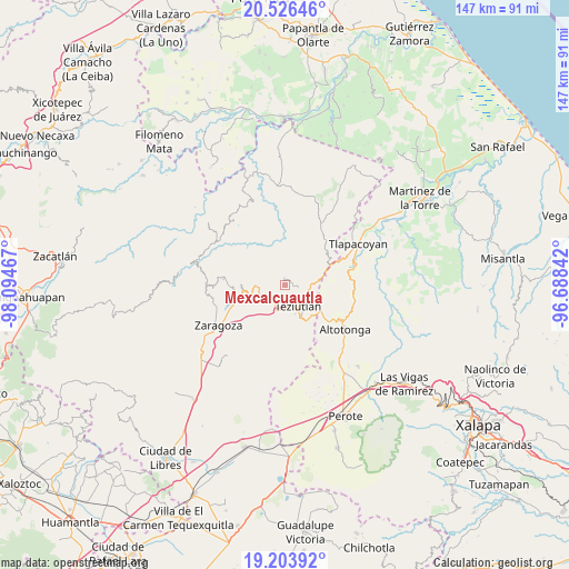
Mexcalcuautla GPS coordinates[2]
19° 51' 59.652" North, 97° 23' 29.544" West
| Map corner | latitude | longitude |
|---|---|---|
| Upper-left | 20.52646°, | -98.09467° |
| Center: | 19.86657°, | -97.39154° |
| Lower-right: | 19.20392°, | -96.68842° |
| Map W x H: | 147.1×147.1 km | = 91.4×91.4mi |
| max Lat: | 32.7° ⇑45.6% North |
| Mexcalcuautla: | 19.86657° |
| min Lat: | ⇓54.4% South 14.53588° |
| min Long | Mexcalcuautla | max Long |
| -117.105° | -97.39154° | -86.73105° |
| W 70.7%⇐ | ⇒29.3% E |
Elevation
Elevation of Mexcalcuautla is 1661 m = 5449 ft, and this is 407.3 m = 1336 ft above average elevation for this country.
| Max E: |
3497 m = 11473 ft | 42.9% |
| Mexcalcuautla | 1661 m 5449 ft | |
| Avg. | 1253.7 m = 4113 ft | |
Min E: |
-1 m = -3 ft | 57.1% |
See also: Mexico elevation on elevation.city.
Geographical zone
Mexcalcuautla is located in North Torrid zone (between Equator and Tropic of Cancer). Distance of this Northern Tropic circle is 397 km =246.7 mi to North.| Distance of | km | miles | from Mexcalcuautla |
|---|---|---|---|
| North Pole | 7798.1 | 4845.5 | to North |
| Arctic Circle | 5192.2 | 3226.3 | to North |
| Tropic Cancer | 397 | 246.7 | to North |
| Equator | 2209 | 1372.6 | to South |


Nearby cities:
15 places around Mexcalcuautla: (largest is in red/bold)
• Ahuatepec
4.2 km =2.6 mi,  277°
277°
• Aire Libre
1.3 km =0.8 mi,  343°
343°
• Atoluca
4.2 km =2.6 mi,  107°
107°
• Cala Norte
3.9 km =2.4 mi,  237°
237°
• Coacalco
3.8 km =2.4 mi,  255°
255°
• Nexpan
3.8 km =2.4 mi,  300°
300°
• San Acateno
2.8 km =1.7 mi,  69°
69°
• San Diego
3.4 km =2.1 mi, 109°
• San Juan Tezongo
3.8 km =2.4 mi,  130°
130°
• San Sebastián
2.5 km =1.6 mi,  120°
120°
• Tanamacoyan
4.8 km =3 mi, 303°
• Tepepan
3.9 km =2.4 mi,  165°
165°
• Tequimila
4.9 km =3 mi, 167°
• Xoloateno
4.6 km =2.9 mi,  149°
149°
• Yopi
4.6 km =2.9 mi, 165°
Sources, notices
• [Note1] Compared only with cities in Mexico existing in our database
• [Src1] Map data: © OpenStreetMap contributors (CC-BY-SA)
• [Src2] Other city data from geonames.org with taken over terms of usage.
• [Src3] Geographical zone / Annual Mean Temperature by Robert A. Rohde @ Wikipedia
