Macuilácatl Grande geodata
Macuilácatl Grande (Veracruz) is a populated place; located in Mexico in America/Mexico_City (GMT-6) time zone. With population of 626 people, there are 13818 cities with bigger population in this country. Compared to other cities in Mexico, 65.6% of cities are located further ↑North; 73.3% of cities are located further ←West and 77.2% of cities have lower elevation than Macuilácatl Grande. Note1


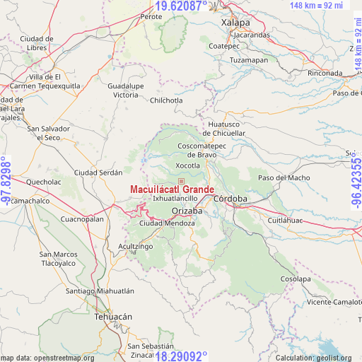
Macuilácatl Grande GPS coordinates[2]
18° 57' 25.992" North, 97° 7' 36.012" West
| Map corner | latitude | longitude |
|---|---|---|
| Upper-left | 19.62087°, | -97.8298° |
| Center: | 18.95722°, | -97.12667° |
| Lower-right: | 18.29092°, | -96.42355° |
| Map W x H: | 147.9×147.9 km | = 91.9×91.9mi |
| max Lat: | 32.7° ⇑65.6% North |
| Macuilácatl Grande: | 18.95722° |
| min Lat: | ⇓34.4% South 14.53588° |
| min Long | Macuilácatl Gr | max Long |
| -117.105° | -97.12667° | -86.73105° |
| W 73.3%⇐ | ⇒26.7% E |
Elevation
Elevation of Macuilácatl Grande is 2071 m = 6795 ft, and this is 817.3 m = 2681 ft above average elevation for this country.
| Max E: |
3497 m = 11473 ft | 22.8% |
| Macuilácatl Grande | 2071 m 6795 ft | |
| Avg. | 1253.7 m = 4113 ft | |
Min E: |
-1 m = -3 ft | 77.2% |
See also: Mexico elevation on elevation.city.
Geographical zone
Macuilácatl Grande is located in North Torrid zone (between Equator and Tropic of Cancer). Distance of this Northern Tropic circle is 498.1 km =309.5 mi to North.| Distance of | km | miles | from Macuilácatl Grande |
|---|---|---|---|
| North Pole | 7899.2 | 4908.3 | to North |
| Arctic Circle | 5293.3 | 3289.1 | to North |
| Tropic Cancer | 498.1 | 309.5 | to North |
| Equator | 2107.8 | 1309.7 | to South |


Nearby cities:
15 places around Macuilácatl Grande: (largest is in red/bold)
• Barrio de San Miguel
2.9 km =1.8 mi,  176°
176°
• Chilapa
4.5 km =2.8 mi,  320°
320°
• Colonia Ejidal
5.1 km =3.2 mi, 180°
• Contla
4.1 km =2.5 mi,  54°
54°
• Cumbre del Español
2.8 km =1.7 mi,  306°
306°
• El Lindero
4.5 km =2.8 mi,  281°
281°
• El Zapote
1.8 km =1.1 mi,  274°
274°
• La Perla
3.3 km =2.1 mi,  192°
192°
• Los Fresnos
2 km =1.2 mi,  231°
231°
• Mariano Escobedo
4.9 km =3 mi, 184°
• Metlac Hernández (Metlac Primero)
2.8 km =1.7 mi, 322°
• Metlac Solano (Metlac Segundo)
3.7 km =2.3 mi,  13°
13°
• Rincón Grande
3.3 km =2.1 mi,  113°
113°
• Tuzantla
3.1 km =1.9 mi, 270°
• Villa Hermosa
3.8 km =2.4 mi,  294°
294°
Sources, notices
• [Note1] Compared only with cities in Mexico existing in our database
• [Src1] Map data: © OpenStreetMap contributors (CC-BY-SA)
• [Src2] Other city data from geonames.org with taken over terms of usage.
• [Src3] Geographical zone / Annual Mean Temperature by Robert A. Rohde @ Wikipedia
