La Perla geodata
La Perla (Veracruz) is a seat of a second-order administrative division; located in Mexico in America/Mexico_City (GMT-6) time zone. With population of 3,939 people, there are 2316 cities with bigger population in this country. Compared to other cities in Mexico, 66.3% of cities are located further ↑North; 73.2% of cities are located further ←West and 56.1% of cities have lower elevation than La Perla. Note1


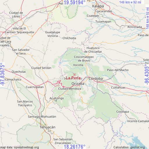
La Perla GPS coordinates[2]
18° 55' 41.412" North, 97° 8' 1.032" West
| Map corner | latitude | longitude |
|---|---|---|
| Upper-left | 19.59194°, | -97.83675° |
| Center: | 18.92817°, | -97.13362° |
| Lower-right: | 18.26176°, | -96.4305° |
| Map W x H: | 147.9×147.9 km | = 91.9×91.9mi |
| max Lat: | 32.7° ⇑66.3% North |
| La Perla: | 18.92817° |
| min Lat: | ⇓33.7% South 14.53588° |
| min Long | La Perla | max Long |
| -117.105° | -97.13362° | -86.73105° |
| W 73.2%⇐ | ⇒26.8% E |
Elevation
Elevation of La Perla is 1624 m = 5328 ft, and this is 370.3 m = 1215 ft above average elevation for this country.
| Max E: |
3497 m = 11473 ft | 43.9% |
| La Perla | 1624 m 5328 ft | |
| Avg. | 1253.7 m = 4113 ft | |
Min E: |
-1 m = -3 ft | 56.1% |
See also: Mexico elevation on elevation.city.
Geographical zone
La Perla is located in North Torrid zone (between Equator and Tropic of Cancer). Distance of this Northern Tropic circle is 501.3 km =311.5 mi to North.| Distance of | km | miles | from La Perla |
|---|---|---|---|
| North Pole | 7902.4 | 4910.3 | to North |
| Arctic Circle | 5296.6 | 3291.2 | to North |
| Tropic Cancer | 501.3 | 311.5 | to North |
| Equator | 2104.6 | 1307.7 | to South |


Nearby cities:
15 places around La Perla: (largest is in red/bold)
• Barrio de San Miguel
1 km =0.6 mi,  68°
68°
• Chicola
4 km =2.5 mi,  137°
137°
• Colonia Ejidal
2 km =1.2 mi,  158°
158°
• Cumbre del Español
5.1 km =3.2 mi,  342°
342°
• El Lindero
5.5 km =3.4 mi,  318°
318°
• El Mirador
3.4 km =2.1 mi, 155°
• El Zapote
3.5 km =2.2 mi, 342°
• Ixhuatlancillo
3.8 km =2.4 mi,  205°
205°
• Los Fresnos
2.2 km =1.4 mi, 337°
• Macuilácatl Grande
3.3 km =2.1 mi,  12°
12°
• Mariano Escobedo
1.7 km =1.1 mi,  167°
167°
• Rancho de Pala
5.1 km =3.2 mi,  184°
184°
• Rincón Grande
4.2 km =2.6 mi,  63°
63°
• San Isidro
4.2 km =2.6 mi, 168°
• Tuzantla
4 km =2.5 mi, 323°
Sources, notices
• [Note1] Compared only with cities in Mexico existing in our database
• [Src1] Map data: © OpenStreetMap contributors (CC-BY-SA)
• [Src2] Other city data from geonames.org with taken over terms of usage.
• [Src3] Geographical zone / Annual Mean Temperature by Robert A. Rohde @ Wikipedia
