Los Ángeles Tetela geodata
Los Ángeles Tetela (Puebla) is a populated place; located in Mexico in America/Mexico_City (GMT-6) time zone. With population of 2,237 people, there are 3927 cities with bigger population in this country. Compared to other cities in Mexico, 67.2% of cities are located further ↑North; 61.7% of cities are located further ←West and 79% of cities have lower elevation than Los Ángeles Tetela. Note1


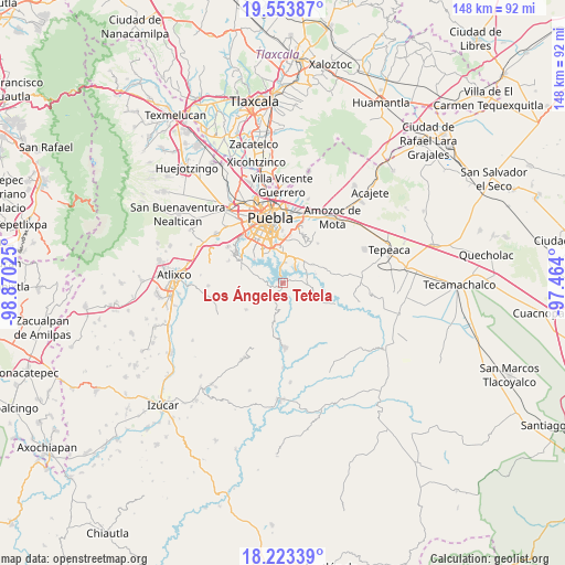
Los Ángeles Tetela GPS coordinates[2]
18° 53' 23.82" North, 98° 10' 1.632" West
| Map corner | latitude | longitude |
|---|---|---|
| Upper-left | 19.55387°, | -98.87025° |
| Center: | 18.88995°, | -98.16712° |
| Lower-right: | 18.22339°, | -97.464° |
| Map W x H: | 147.9×147.9 km | = 91.9×91.9mi |
| max Lat: | 32.7° ⇑67.2% North |
| Los Ángeles Tetela: | 18.88995° |
| min Lat: | ⇓32.8% South 14.53588° |
| min Long | Los Ángeles Te | max Long |
| -117.105° | -98.16712° | -86.73105° |
| W 61.7%⇐ | ⇒38.3% E |
Elevation
Elevation of Los Ángeles Tetela is 2116 m = 6942 ft, and this is 862.3 m = 2829 ft above average elevation for this country.
| Max E: |
3497 m = 11473 ft | 21% |
| Los Ángeles Tetela | 2116 m 6942 ft | |
| Avg. | 1253.7 m = 4113 ft | |
Min E: |
-1 m = -3 ft | 79% |
See also: Mexico elevation on elevation.city.
Geographical zone
Los Ángeles Tetela is located in North Torrid zone (between Equator and Tropic of Cancer). Distance of this Northern Tropic circle is 505.6 km =314.2 mi to North.| Distance of | km | miles | from Los Ángeles Tetela |
|---|---|---|---|
| North Pole | 7906.7 | 4913 | to North |
| Arctic Circle | 5300.8 | 3293.8 | to North |
| Tropic Cancer | 505.6 | 314.2 | to North |
| Equator | 2100.4 | 1305.1 | to South |


Nearby cities:
15 places around Los Ángeles Tetela: (largest is in red/bold)
• 18 de Marzo
8.8 km =5.5 mi,  4°
4°
• Artículo Primero Constitucional
9.4 km =5.8 mi,  5°
5°
• Buenavista Tetela
3.4 km =2.1 mi,  343°
343°
• Guadalupe
7.6 km =4.7 mi, 9°
• La Paz Tlaxcolpan
5.9 km =3.7 mi,  283°
283°
• Resurgimiento Atotonilco
8 km =5 mi,  329°
329°
• San Andrés Azumiatla
9.1 km =5.7 mi, 279°
• San Antonio Arenillas
6.7 km =4.2 mi,  351°
351°
• San José Texaluca
3.8 km =2.4 mi,  77°
77°
• San José Xacxamayo
3.1 km =1.9 mi,  178°
178°
• San José el Rincón
3.4 km =2.1 mi,  262°
262°
• San Juan Tepepa
9.4 km =5.8 mi, 8°
• San Pedro Zacachimalpa
6 km =3.7 mi, 11°
• Santa María Guadalupe Tecola
3.5 km =2.2 mi,  301°
301°
• Santo Tomás Chautla
8.6 km =5.3 mi, 10°
Sources, notices
• [Note1] Compared only with cities in Mexico existing in our database
• [Src1] Map data: © OpenStreetMap contributors (CC-BY-SA)
• [Src2] Other city data from geonames.org with taken over terms of usage.
• [Src3] Geographical zone / Annual Mean Temperature by Robert A. Rohde @ Wikipedia
