Santo Tomás Chautla geodata
Santo Tomás Chautla (Puebla) is a populated place; located in Mexico in America/Mexico_City (GMT-6) time zone. With population of 6,540 people, there are 1434 cities with bigger population in this country. Compared to other cities in Mexico, 65.5% of cities are located further ↑North; 61.9% of cities are located further ←West and 80.6% of cities have lower elevation than Santo Tomás Chautla. Note1


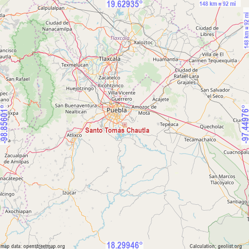
Santo Tomás Chautla GPS coordinates[2]
18° 57' 56.628" North, 98° 9' 10.368" West
| Map corner | latitude | longitude |
|---|---|---|
| Upper-left | 19.62935°, | -98.85601° |
| Center: | 18.96573°, | -98.15288° |
| Lower-right: | 18.29946°, | -97.44976° |
| Map W x H: | 147.9×147.9 km | = 91.9×91.9mi |
| max Lat: | 32.7° ⇑65.5% North |
| Santo Tomás Chautla: | 18.96573° |
| min Lat: | ⇓34.5% South 14.53588° |
| min Long | Santo Tomás Ch | max Long |
| -117.105° | -98.15288° | -86.73105° |
| W 61.9%⇐ | ⇒38.1% E |
Elevation
Elevation of Santo Tomás Chautla is 2155 m = 7070 ft, and this is 901.3 m = 2957 ft above average elevation for this country.
| Max E: |
3497 m = 11473 ft | 19.4% |
| Santo Tomás Chautla | 2155 m 7070 ft | |
| Avg. | 1253.7 m = 4113 ft | |
Min E: |
-1 m = -3 ft | 80.6% |
See also: Mexico elevation on elevation.city.
Geographical zone
Santo Tomás Chautla is located in North Torrid zone (between Equator and Tropic of Cancer). Distance of this Northern Tropic circle is 497.1 km =308.9 mi to North.| Distance of | km | miles | from Santo Tomás Chautla |
|---|---|---|---|
| North Pole | 7898.3 | 4907.8 | to North |
| Arctic Circle | 5292.4 | 3288.5 | to North |
| Tropic Cancer | 497.1 | 308.9 | to North |
| Equator | 2108.8 | 1310.3 | to South |


Nearby cities:
15 places around Santo Tomás Chautla: (largest is in red/bold)
• 18 de Marzo
0.9 km =0.6 mi,  294°
294°
• Artículo Primero Constitucional
1.1 km =0.7 mi,  327°
327°
• Buenavista Tetela
5.7 km =3.5 mi,  205°
205°
• Casa Blanca
9.2 km =5.7 mi,  22°
22°
• Galaxia la Calera
3.7 km =2.3 mi,  0°
0°
• Guadalupe
0.9 km =0.6 mi,  195°
195°
• Los Ángeles Tetela
8.6 km =5.3 mi,  190°
190°
• Puebla
9.6 km =6 mi, 326°
• Resurgimiento Atotonilco
5.8 km =3.6 mi,  254°
254°
• San Antonio Arenillas
3.1 km =1.9 mi,  234°
234°
• San José Texaluca
7.9 km =4.9 mi,  164°
164°
• San Juan Tepepa
0.9 km =0.6 mi,  349°
349°
• San Pedro Zacachimalpa
2.6 km =1.6 mi, 187°
• Santa Cruz Alpuyeca
7.8 km =4.8 mi,  76°
76°
• Santa María Guadalupe Tecola
8 km =5 mi, 214°
Sources, notices
• [Note1] Compared only with cities in Mexico existing in our database
• [Src1] Map data: © OpenStreetMap contributors (CC-BY-SA)
• [Src2] Other city data from geonames.org with taken over terms of usage.
• [Src3] Geographical zone / Annual Mean Temperature by Robert A. Rohde @ Wikipedia
