La Ventosa geodata
La Ventosa (Oaxaca) is a populated place; located in Mexico in America/Mexico_City (GMT-6) time zone. With population of 4,884 people, there are 1893 cities with bigger population in this country. Compared to other cities in Mexico, 94% of cities are located further ↑North; 84.8% of cities are located further ←West and 88% of cities have higher elevation than La Ventosa. Note1


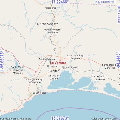
La Ventosa GPS coordinates[2]
16° 33' 6.768" North, 94° 56' 51.432" West
| Map corner | latitude | longitude |
|---|---|---|
| Upper-left | 17.22468°, | -95.65075° |
| Center: | 16.55188°, | -94.94762° |
| Lower-right: | 15.87673°, | -94.2445° |
| Map W x H: | 149.9×149.9 km | = 93.1×93.1mi |
| max Lat: | 32.7° ⇑94% North |
| La Ventosa: | 16.55188° |
| min Lat: | ⇓6% South 14.53588° |
| min Long | La Ventosa | max Long |
| -117.105° | -94.94762° | -86.73105° |
| W 84.8%⇐ | ⇒15.2% E |
Elevation
Elevation of La Ventosa is 30 m = 98 ft, and this is 1223.7 m = 4015 ft below average elevation for this country.
| Max E: |
3497 m = 11473 ft | 88% |
| Avg. | 1253.7 m = 4113 ft | |
| La Ventosa | 30 m = 98 ft | |
Min E: |
-1 m = -3 ft | 12% |
See also: Mexico elevation on elevation.city.
Geographical zone
La Ventosa is located in North Torrid zone (between Equator and Tropic of Cancer). Distance of this Northern Tropic circle is 765.5 km =475.7 mi to North.| Distance of | km | miles | from La Ventosa |
|---|---|---|---|
| North Pole | 8166.7 | 5074.6 | to North |
| Arctic Circle | 5560.8 | 3455.3 | to North |
| Tropic Cancer | 765.5 | 475.7 | to North |
| Equator | 1840.4 | 1143.6 | to South |


Nearby cities:
15 places around La Ventosa: (largest is in red/bold)
• Asunción Ixtaltepec
13.3 km =8.3 mi,  245°
245°
• Chicapa de Castro
18.4 km =11.4 mi,  133°
133°
• Chivela
18.8 km =11.7 mi,  343°
343°
• El Espinal
12.3 km =7.6 mi,  233°
233°
• El Porvenir
20.4 km =12.7 mi,  57°
57°
• Ixtepec
16.7 km =10.4 mi,  273°
273°
• Juchitán de Zaragoza
15 km =9.3 mi,  210°
210°
• La Venta
14 km =8.7 mi,  81°
81°
• Lázaro Cárdenas
21.7 km =13.5 mi,  25°
25°
• Rancho el Llano
26.9 km =16.7 mi,  235°
235°
• San Pedro Comitancillo
23.3 km =14.5 mi, 253°
• Santa María Xadani
22.4 km =13.9 mi,  199°
199°
• Santiago Ixtaltepec
15.8 km =9.8 mi,  16°
16°
• Santo Domingo Chihuitán
23.4 km =14.5 mi,  280°
280°
• Unión Hidalgo
15.4 km =9.6 mi, 125°
Sources, notices
• [Note1] Compared only with cities in Mexico existing in our database
• [Src1] Map data: © OpenStreetMap contributors (CC-BY-SA)
• [Src2] Other city data from geonames.org with taken over terms of usage.
• [Src3] Geographical zone / Annual Mean Temperature by Robert A. Rohde @ Wikipedia
