Ixhuatlancillo geodata
Ixhuatlancillo (Veracruz) is a seat of a second-order administrative division; located in Mexico in America/Mexico_City (GMT-6) time zone. With population of 4,975 people, there are 1858 cities with bigger population in this country. Compared to other cities in Mexico, 67.1% of cities are located further ↑North; 73% of cities are located further ←West and 50.1% of cities have lower elevation than Ixhuatlancillo. Note1


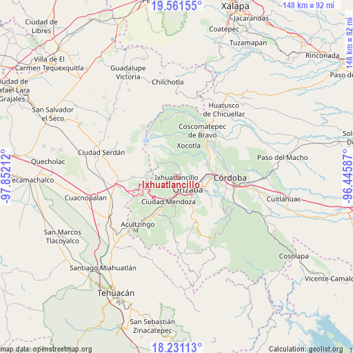
Ixhuatlancillo GPS coordinates[2]
18° 53' 51.576" North, 97° 8' 56.364" West
| Map corner | latitude | longitude |
|---|---|---|
| Upper-left | 19.56155°, | -97.85212° |
| Center: | 18.89766°, | -97.14899° |
| Lower-right: | 18.23113°, | -96.44587° |
| Map W x H: | 147.9×147.9 km | = 91.9×91.9mi |
| max Lat: | 32.7° ⇑67.1% North |
| Ixhuatlancillo: | 18.89766° |
| min Lat: | ⇓32.9% South 14.53588° |
| min Long | Ixhuatlancillo | max Long |
| -117.105° | -97.14899° | -86.73105° |
| W 73%⇐ | ⇒27% E |
Elevation
Elevation of Ixhuatlancillo is 1439 m = 4721 ft, and this is 185.3 m = 608 ft above average elevation for this country.
| Max E: |
3497 m = 11473 ft | 49.9% |
| Ixhuatlancillo | 1439 m 4721 ft | |
| Avg. | 1253.7 m = 4113 ft | |
Min E: |
-1 m = -3 ft | 50.1% |
See also: Mexico elevation on elevation.city.
Geographical zone
Ixhuatlancillo is located in North Torrid zone (between Equator and Tropic of Cancer). Distance of this Northern Tropic circle is 504.7 km =313.6 mi to North.| Distance of | km | miles | from Ixhuatlancillo |
|---|---|---|---|
| North Pole | 7905.8 | 4912.4 | to North |
| Arctic Circle | 5300 | 3293.3 | to North |
| Tropic Cancer | 504.7 | 313.6 | to North |
| Equator | 2101.2 | 1305.6 | to South |


Nearby cities:
15 places around Ixhuatlancillo: (largest is in red/bold)
• Barrio de San Miguel
4.5 km =2.8 mi,  33°
33°
• Chicola
4.3 km =2.7 mi,  84°
84°
• Colonia Ejidal
2.8 km =1.7 mi,  57°
57°
• El Mirador
3 km =1.9 mi, 83°
• El Zapote
6.8 km =4.2 mi,  4°
4°
• Fraccionamiento Valle Dorado
4.3 km =2.7 mi,  138°
138°
• La Perla
3.8 km =2.4 mi, 25°
• Los Fresnos
5.4 km =3.4 mi,  8°
8°
• Mariano Escobedo
2.7 km =1.7 mi,  48°
48°
• Palmira
4.3 km =2.7 mi,  112°
112°
• Rancho de Pala
2 km =1.2 mi, 143°
• Revolución
6.2 km =3.9 mi,  100°
100°
• San Isidro
2.5 km =1.6 mi, 106°
• Tuzantla
6.7 km =4.2 mi,  353°
353°
• Unión y Progreso
4.2 km =2.6 mi,  131°
131°
Sources, notices
• [Note1] Compared only with cities in Mexico existing in our database
• [Src1] Map data: © OpenStreetMap contributors (CC-BY-SA)
• [Src2] Other city data from geonames.org with taken over terms of usage.
• [Src3] Geographical zone / Annual Mean Temperature by Robert A. Rohde @ Wikipedia
