La Ladrillera geodata
La Ladrillera (State of Mexico) is a populated place; located in Mexico in America/Mexico_City (GMT-6) time zone. With population of 829 people, there are 10549 cities with bigger population in this country. Compared to other cities in Mexico, 66.3% of cities are located further ↑North; 56.7% of cities are located further →East and 55.2% of cities have lower elevation than La Ladrillera. Note1


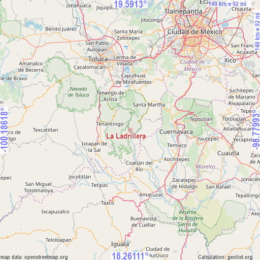
La Ladrillera GPS coordinates[2]
18° 55' 39.108" North, 99° 28' 58.98" West
| Map corner | latitude | longitude |
|---|---|---|
| Upper-left | 19.5913°, | -100.18618° |
| Center: | 18.92753°, | -99.48305° |
| Lower-right: | 18.26111°, | -98.77993° |
| Map W x H: | 147.9×147.9 km | = 91.9×91.9mi |
| max Lat: | 32.7° ⇑66.3% North |
| La Ladrillera: | 18.92753° |
| min Lat: | ⇓33.7% South 14.53588° |
| min Long | La Ladrillera | max Long |
| -117.105° | -99.48305° | -86.73105° |
| W 43.3%⇐ | ⇒56.7% E |
Elevation
Elevation of La Ladrillera is 1594 m = 5230 ft, and this is 340.3 m = 1116 ft above average elevation for this country.
| Max E: |
3497 m = 11473 ft | 44.8% |
| La Ladrillera | 1594 m 5230 ft | |
| Avg. | 1253.7 m = 4113 ft | |
Min E: |
-1 m = -3 ft | 55.2% |
See also: Mexico elevation on elevation.city.
Geographical zone
La Ladrillera is located in North Torrid zone (between Equator and Tropic of Cancer). Distance of this Northern Tropic circle is 501.4 km =311.6 mi to North.| Distance of | km | miles | from La Ladrillera |
|---|---|---|---|
| North Pole | 7902.5 | 4910.4 | to North |
| Arctic Circle | 5296.6 | 3291.2 | to North |
| Tropic Cancer | 501.4 | 311.6 | to North |
| Equator | 2104.5 | 1307.7 | to South |


Nearby cities:
15 places around La Ladrillera: (largest is in red/bold)
• Chalma
5.1 km =3.2 mi,  86°
86°
• Chalmita
6.3 km =3.9 mi,  83°
83°
• El Carmen (El Desierto del Carmen)
7.8 km =4.8 mi,  264°
264°
• El Puentecito
1.6 km =1 mi,  140°
140°
• Jalmolonga (La Hacienda)
1.5 km =0.9 mi,  228°
228°
• La Cañada
6.2 km =3.9 mi,  73°
73°
• Los Manantiales (El Río Chiquito)
4.6 km =2.9 mi, 90°
• Malinalco
2.7 km =1.7 mi,  329°
329°
• Palmar de Guadalupe
6 km =3.7 mi,  245°
245°
• Plaza Nueva
5.1 km =3.2 mi, 87°
• Puente Caporal (La Guancha)
4.1 km =2.5 mi,  133°
133°
• San José Tenería (Tenería)
6.8 km =4.2 mi,  291°
291°
• San Miguel Tecomatlán
7.4 km =4.6 mi,  319°
319°
• San Nicolás
5.2 km =3.2 mi,  346°
346°
• San Sebastián
5.9 km =3.7 mi,  0°
0°
Sources, notices
• [Note1] Compared only with cities in Mexico existing in our database
• [Src1] Map data: © OpenStreetMap contributors (CC-BY-SA)
• [Src2] Other city data from geonames.org with taken over terms of usage.
• [Src3] Geographical zone / Annual Mean Temperature by Robert A. Rohde @ Wikipedia
