La Joya geodata
La Joya (Morelos) is a populated place; located in Mexico in America/Mexico_City (GMT-6) time zone. With population of 13,158 people, there are 745 cities with bigger population in this country. Compared to other cities in Mexico, 70.6% of cities are located further ↑North; 56.5% of cities are located further →East and 59.9% of cities have higher elevation than La Joya. Note1


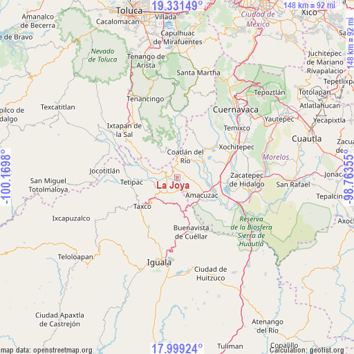
La Joya GPS coordinates[2]
18° 40' 0.012" North, 99° 28' 0.012" West
| Map corner | latitude | longitude |
|---|---|---|
| Upper-left | 19.33149°, | -100.1698° |
| Center: | 18.66667°, | -99.46667° |
| Lower-right: | 17.99924°, | -98.76355° |
| Map W x H: | 148.1×148.1 km | = 92×92mi |
| max Lat: | 32.7° ⇑70.6% North |
| La Joya: | 18.66667° |
| min Lat: | ⇓29.4% South 14.53588° |
| min Long | La Joya | max Long |
| -117.105° | -99.46667° | -86.73105° |
| W 43.5%⇐ | ⇒56.5% E |
Elevation
Elevation of La Joya is 1010 m = 3314 ft, and this is 243.7 m = 800 ft below average elevation for this country.
| Max E: |
3497 m = 11473 ft | 59.9% |
| Avg. | 1253.7 m = 4113 ft | |
| La Joya | 1010 m = 3314 ft | |
Min E: |
-1 m = -3 ft | 40.1% |
See also: Mexico elevation on elevation.city.
Geographical zone
La Joya is located in North Torrid zone (between Equator and Tropic of Cancer). Distance of this Northern Tropic circle is 530.4 km =329.6 mi to North.| Distance of | km | miles | from La Joya |
|---|---|---|---|
| North Pole | 7931.5 | 4928.4 | to North |
| Arctic Circle | 5325.6 | 3309.2 | to North |
| Tropic Cancer | 530.4 | 329.6 | to North |
| Equator | 2075.5 | 1289.7 | to South |


Nearby cities:
15 places around La Joya: (largest is in red/bold)
• Apancingo
1.5 km =0.9 mi,  12°
12°
• Axixintla
9 km =5.6 mi,  217°
217°
• Cacahuamilpa
4.4 km =2.7 mi,  292°
292°
• Chavarría
6.6 km =4.1 mi,  358°
358°
• Coatlán del Río
9.3 km =5.8 mi,  22°
22°
• Cocoyotla
9.9 km =6.2 mi, 9°
• Colonia Cuauhtémoc
9.8 km =6.1 mi, 13°
• Colonia Sonora
9.6 km =6 mi,  37°
37°
• Cuauchichinola
9.6 km =6 mi,  91°
91°
• Huajintlán
7.8 km =4.8 mi,  145°
145°
• Michapa
4.2 km =2.6 mi,  341°
341°
• San José el Potrero
2.4 km =1.5 mi,  192°
192°
• Teacalco
5.7 km =3.5 mi,  164°
164°
• Texcaltitla
9.8 km =6.1 mi, 192°
• Tilancingo
8 km =5 mi, 9°
Sources, notices
• [Note1] Compared only with cities in Mexico existing in our database
• [Src1] Map data: © OpenStreetMap contributors (CC-BY-SA)
• [Src2] Other city data from geonames.org with taken over terms of usage.
• [Src3] Geographical zone / Annual Mean Temperature by Robert A. Rohde @ Wikipedia
