Unión y Progreso geodata
Unión y Progreso (Veracruz) is a populated place; located in Mexico in America/Mexico_City (GMT-6) time zone. With population of 8,181 people, there are 1159 cities with bigger population in this country. Compared to other cities in Mexico, 67.6% of cities are located further ↑North; 73.4% of cities are located further ←West and 52.1% of cities have higher elevation than Unión y Progreso. Note1


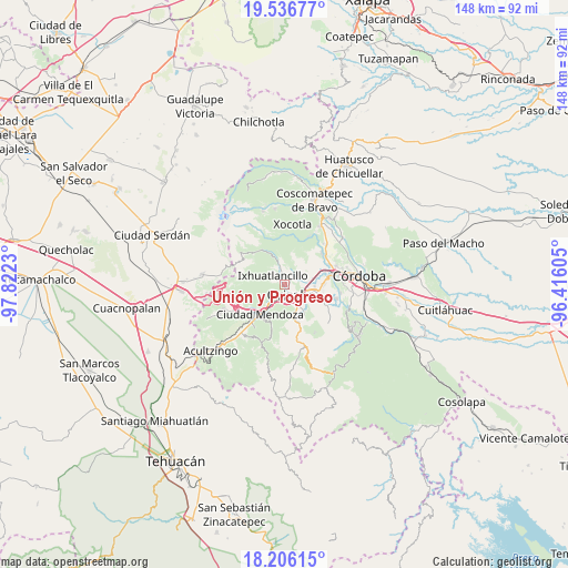
Unión y Progreso GPS coordinates[2]
18° 52' 22.008" North, 97° 7' 9.012" West
| Map corner | latitude | longitude |
|---|---|---|
| Upper-left | 19.53677°, | -97.8223° |
| Center: | 18.87278°, | -97.11917° |
| Lower-right: | 18.20615°, | -96.41605° |
| Map W x H: | 148×148 km | = 92×92mi |
| max Lat: | 32.7° ⇑67.6% North |
| Unión y Progreso: | 18.87278° |
| min Lat: | ⇓32.4% South 14.53588° |
| min Long | Unión y Progre | max Long |
| -117.105° | -97.11917° | -86.73105° |
| W 73.4%⇐ | ⇒26.6% E |
Elevation
Elevation of Unión y Progreso is 1334 m = 4377 ft, and this is 80.3 m = 263 ft above average elevation for this country.
| Max E: |
3497 m = 11473 ft | 52.1% |
| Unión y Progreso | 1334 m 4377 ft | |
| Avg. | 1253.7 m = 4113 ft | |
Min E: |
-1 m = -3 ft | 47.9% |
See also: Mexico elevation on elevation.city.
Geographical zone
Unión y Progreso is located in North Torrid zone (between Equator and Tropic of Cancer). Distance of this Northern Tropic circle is 507.5 km =315.3 mi to North.| Distance of | km | miles | from Unión y Progreso |
|---|---|---|---|
| North Pole | 7908.6 | 4914.2 | to North |
| Arctic Circle | 5302.7 | 3294.9 | to North |
| Tropic Cancer | 507.5 | 315.3 | to North |
| Equator | 2098.5 | 1303.9 | to South |


Nearby cities:
15 places around Unión y Progreso: (largest is in red/bold)
• Atzacan
5.4 km =3.4 mi,  44°
44°
• Chicola
3.4 km =2.1 mi,  20°
20°
• Colonia Ejidal
4.3 km =2.7 mi,  349°
349°
• Donato Guerra
5.1 km =3.2 mi,  164°
164°
• El Mirador
3.1 km =1.9 mi,  357°
357°
• Fraccionamiento Valle Dorado
0.5 km =0.3 mi,  216°
216°
• Ixhuatlancillo
4.2 km =2.6 mi,  311°
311°
• Mariano Escobedo
4.7 km =2.9 mi, 345°
• Orizaba
3.1 km =1.9 mi,  138°
138°
• Palmira
1.4 km =0.9 mi, 36°
• Paredón Viejo
4.5 km =2.8 mi,  202°
202°
• Rancho de Pala
2.2 km =1.4 mi,  299°
299°
• Revolución
3.4 km =2.1 mi,  60°
60°
• San Cristóbal
4.8 km =3 mi,  185°
185°
• San Isidro
2.2 km =1.4 mi,  341°
341°
Sources, notices
• [Note1] Compared only with cities in Mexico existing in our database
• [Src1] Map data: © OpenStreetMap contributors (CC-BY-SA)
• [Src2] Other city data from geonames.org with taken over terms of usage.
• [Src3] Geographical zone / Annual Mean Temperature by Robert A. Rohde @ Wikipedia
