Revolución geodata
Revolución (Veracruz) is a populated place; located in Mexico in America/Mexico_City (GMT-6) time zone. With population of 756 people, there are 11581 cities with bigger population in this country. Compared to other cities in Mexico, 67.3% of cities are located further ↑North; 73.7% of cities are located further ←West and 53% of cities have higher elevation than Revolución. Note1


Revolución GPS coordinates[2]
18° 53' 16.008" North, 97° 5' 29.004" West
| Map corner | latitude | longitude |
|---|---|---|
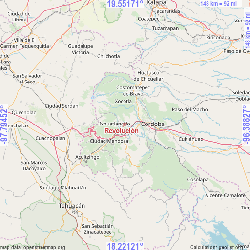
| Upper-left | 19.55171°, | -97.79452° |
| Center: | 18.88778°, | -97.09139° |
| Lower-right: | 18.22121°, | -96.38827° |
| Map W x H: | 147.9×147.9 km | = 91.9×91.9mi |
| max Lat: | 32.7° ⇑67.3% North |
| Revolución: | 18.88778° |
| min Lat: | ⇓32.7% South 14.53588° |
| min Long | Revolución | max Long |
| -117.105° | -97.09139° | -86.73105° |
| W 73.7%⇐ | ⇒26.3% E |
Elevation
Elevation of Revolución is 1290 m = 4232 ft, and this is 36.3 m = 119 ft above average elevation for this country.
| Max E: |
3497 m = 11473 ft | 53% |
| Revolución | 1290 m 4232 ft | |
| Avg. | 1253.7 m = 4113 ft | |
Min E: |
-1 m = -3 ft | 47% |
See also: Mexico elevation on elevation.city.
Geographical zone
Revolución is located in North Torrid zone (between Equator and Tropic of Cancer). Distance of this Northern Tropic circle is 505.8 km =314.3 mi to North.| Distance of | km | miles | from Revolución |
|---|---|---|---|
| North Pole | 7906.9 | 4913.1 | to North |
| Arctic Circle | 5301 | 3293.9 | to North |
| Tropic Cancer | 505.8 | 314.3 | to North |
| Equator | 2100.1 | 1304.9 | to South |


Nearby cities:
15 places around Revolución: (largest is in red/bold)
• Atzacan
2.3 km =1.4 mi,  22°
22°
• Chicola
2.3 km =1.4 mi,  310°
310°
• Colonia Ejidal
4.5 km =2.8 mi,  304°
304°
• El Mirador
3.4 km =2.1 mi, 295°
• Fraccionamiento Valle Dorado
3.9 km =2.4 mi,  237°
237°
• Ixtaczoquitlán
4.9 km =3 mi,  141°
141°
• La Sidra
5.3 km =3.3 mi,  13°
13°
• Lagunilla
4.6 km =2.9 mi,  55°
55°
• Mariano Escobedo
5 km =3.1 mi, 304°
• Moyoapan
5.8 km =3.6 mi, 56°
• Orizaba
4.1 km =2.5 mi,  192°
192°
• Palmira
2.2 km =1.4 mi,  255°
255°
• Rancho de Pala
4.9 km =3 mi, 263°
• San Isidro
3.6 km =2.2 mi,  275°
275°
• Unión y Progreso
3.4 km =2.1 mi, 240°
Sources, notices
• [Note1] Compared only with cities in Mexico existing in our database
• [Src1] Map data: © OpenStreetMap contributors (CC-BY-SA)
• [Src2] Other city data from geonames.org with taken over terms of usage.
• [Src3] Geographical zone / Annual Mean Temperature by Robert A. Rohde @ Wikipedia
