Fontezuelas geodata
Fontezuelas (Hidalgo) is a populated place; located in Mexico in America/Mexico_City (GMT-6) time zone. With population of 1,236 people, there are 7022 cities with bigger population in this country. Compared to other cities in Mexico, 67.6% of cities are located further ↓South; 52.4% of cities are located further ←West and 75.6% of cities have lower elevation than Fontezuelas. Note1


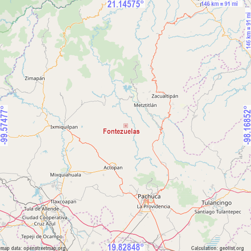
Fontezuelas GPS coordinates[2]
20° 29' 18.708" North, 98° 52' 17.904" West
| Map corner | latitude | longitude |
|---|---|---|
| Upper-left | 21.14575°, | -99.57477° |
| Center: | 20.48853°, | -98.87164° |
| Lower-right: | 19.82848°, | -98.16852° |
| Map W x H: | 146.5×146.5 km | = 91×91mi |
| max Lat: | 32.7° ⇑32.4% North |
| Fontezuelas: | 20.48853° |
| min Lat: | ⇓67.6% South 14.53588° |
| min Long | Fontezuelas | max Long |
| -117.105° | -98.87164° | -86.73105° |
| W 52.4%⇐ | ⇒47.6% E |
Elevation
Elevation of Fontezuelas is 2040 m = 6693 ft, and this is 786.3 m = 2580 ft above average elevation for this country.
| Max E: |
3497 m = 11473 ft | 24.4% |
| Fontezuelas | 2040 m 6693 ft | |
| Avg. | 1253.7 m = 4113 ft | |
Min E: |
-1 m = -3 ft | 75.6% |
See also: Mexico elevation on elevation.city.
Geographical zone
Fontezuelas is located in North Torrid zone (between Equator and Tropic of Cancer). Distance of this Northern Tropic circle is 327.8 km =203.7 mi to North.| Distance of | km | miles | from Fontezuelas |
|---|---|---|---|
| North Pole | 7729 | 4802.6 | to North |
| Arctic Circle | 5123.1 | 3183.3 | to North |
| Tropic Cancer | 327.8 | 203.7 | to North |
| Equator | 2278.1 | 1415.5 | to South |


Nearby cities:
15 places around Fontezuelas: (largest is in red/bold)
• Cerro Colorado
18.4 km =11.4 mi,  119°
119°
• Dajiedi
21 km =13 mi,  199°
199°
• El Mezquital
20.2 km =12.6 mi,  230°
230°
• González Ortega
17.9 km =11.1 mi,  221°
221°
• Guerrero
19.6 km =12.2 mi, 226°
• La Estancia
19.7 km =12.2 mi,  190°
190°
• Metztitlán
16.4 km =10.2 mi,  43°
43°
• Pozuelos
19.6 km =12.2 mi,  271°
271°
• San Andrés Daboxtha
20.5 km =12.7 mi,  281°
281°
• San Cristóbal
17.5 km =10.9 mi,  14°
14°
• Santa Mónica Autempa
17.8 km =11.1 mi,  101°
101°
• Santiago de Anaya
15.2 km =9.4 mi, 219°
• Tlatepexe
15.6 km =9.7 mi, 35°
• Xitzo
15.1 km =9.4 mi,  210°
210°
• Zaragoza
16.6 km =10.3 mi, 209°
Sources, notices
• [Note1] Compared only with cities in Mexico existing in our database
• [Src1] Map data: © OpenStreetMap contributors (CC-BY-SA)
• [Src2] Other city data from geonames.org with taken over terms of usage.
• [Src3] Geographical zone / Annual Mean Temperature by Robert A. Rohde @ Wikipedia
