Pozuelos geodata
Pozuelos (Hidalgo) is a populated place; located in Mexico in America/Mexico_City (GMT-6) time zone. With population of 1,061 people, there are 8225 cities with bigger population in this country. Compared to other cities in Mexico, 67.6% of cities are located further ↓South; 50.6% of cities are located further →East and 75.1% of cities have lower elevation than Pozuelos. Note1


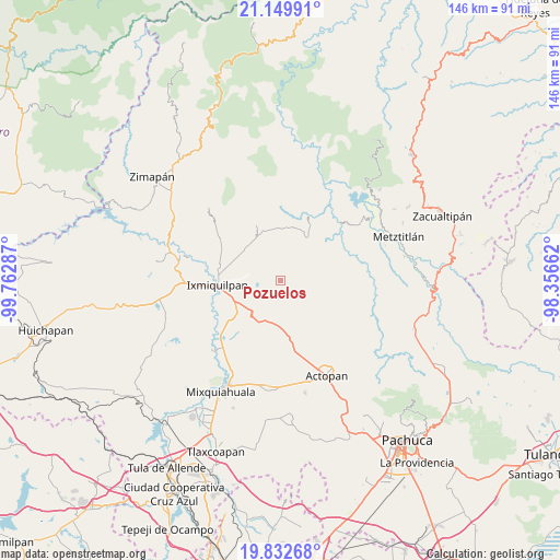
Pozuelos GPS coordinates[2]
20° 29' 33.756" North, 99° 3' 35.064" West
| Map corner | latitude | longitude |
|---|---|---|
| Upper-left | 21.14991°, | -99.76287° |
| Center: | 20.49271°, | -99.05974° |
| Lower-right: | 19.83268°, | -98.35662° |
| Map W x H: | 146.5×146.5 km | = 91×91mi |
| max Lat: | 32.7° ⇑32.4% North |
| Pozuelos: | 20.49271° |
| min Lat: | ⇓67.6% South 14.53588° |
| min Long | Pozuelos | max Long |
| -117.105° | -99.05974° | -86.73105° |
| W 49.4%⇐ | ⇒50.6% E |
Elevation
Elevation of Pozuelos is 2033 m = 6670 ft, and this is 779.3 m = 2557 ft above average elevation for this country.
| Max E: |
3497 m = 11473 ft | 24.9% |
| Pozuelos | 2033 m 6670 ft | |
| Avg. | 1253.7 m = 4113 ft | |
Min E: |
-1 m = -3 ft | 75.1% |
See also: Mexico elevation on elevation.city.
Geographical zone
Pozuelos is located in North Torrid zone (between Equator and Tropic of Cancer). Distance of this Northern Tropic circle is 327.3 km =203.4 mi to North.| Distance of | km | miles | from Pozuelos |
|---|---|---|---|
| North Pole | 7728.5 | 4802.3 | to North |
| Arctic Circle | 5122.6 | 3183 | to North |
| Tropic Cancer | 327.3 | 203.4 | to North |
| Equator | 2278.6 | 1415.9 | to South |


Nearby cities:
15 places around Pozuelos: (largest is in red/bold)
• Arenalito Remedios
12.5 km =7.8 mi,  277°
277°
• Bangandhó
9.4 km =5.8 mi,  263°
263°
• Capula
8.3 km =5.2 mi, 282°
• Colonia el Mirador
10.5 km =6.5 mi,  272°
272°
• Durango Daboxtha
5.8 km =3.6 mi,  351°
351°
• El Tephé
13 km =8.1 mi,  247°
247°
• Ex- Hacienda de Ocotza
8.3 km =5.2 mi,  206°
206°
• Julián Villagrán
11.7 km =7.3 mi,  203°
203°
• La Estación
11 km =6.8 mi, 272°
• Pueblo Nuevo
11.9 km =7.4 mi, 249°
• San Andrés Daboxtha
3.7 km =2.3 mi, 352°
• San Pedro Capula
10.4 km =6.5 mi, 282°
• Santa Teresa Daboxtha
7.4 km =4.6 mi, 353°
• Taxadho
11.4 km =7.1 mi,  234°
234°
• Yolotepec
11.8 km =7.3 mi,  186°
186°
Sources, notices
• [Note1] Compared only with cities in Mexico existing in our database
• [Src1] Map data: © OpenStreetMap contributors (CC-BY-SA)
• [Src2] Other city data from geonames.org with taken over terms of usage.
• [Src3] Geographical zone / Annual Mean Temperature by Robert A. Rohde @ Wikipedia
