Santa Mónica Autempa geodata
Santa Mónica Autempa (Hidalgo) is a populated place; located in Mexico in America/Mexico_City (GMT-6) time zone. With population of 505 people, there are 16660 cities with bigger population in this country. Compared to other cities in Mexico, 66.8% of cities are located further ↓South; 55% of cities are located further ←West and 65.7% of cities have lower elevation than Santa Mónica Autempa. Note1
Current local time in Santa Mónica Autempa:
08:27 AM, WednesdayDifference from your time zone: hours


Santa Mónica Autempa GPS coordinates[2]
20° 27' 24.084" North, 98° 42' 15.192" West
| Map corner | latitude | longitude |
|---|---|---|
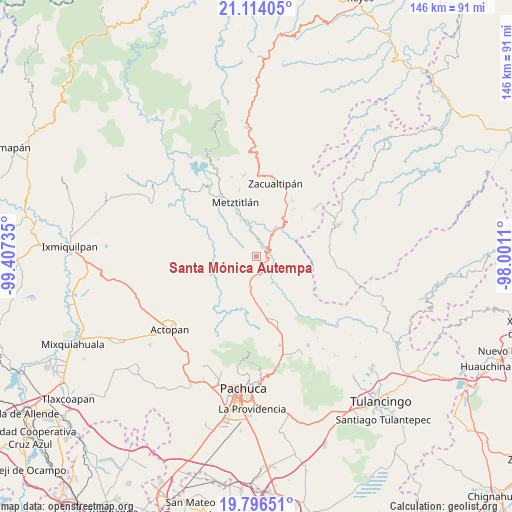
| Upper-left | 21.11405°, | -99.40735° |
| Center: | 20.45669°, | -98.70422° |
| Lower-right: | 19.79651°, | -98.0011° |
| Map W x H: | 146.5×146.5 km | = 91×91mi |
| max Lat: | 32.7° ⇑33.2% North |
| Santa Mónica Autempa: | 20.45669° |
| min Lat: | ⇓66.8% South 14.53588° |
| min Long | Santa Mónica A | max Long |
| -117.105° | -98.70422° | -86.73105° |
| W 55%⇐ | ⇒45% E |
Elevation
Elevation of Santa Mónica Autempa is 1845 m = 6053 ft, and this is 591.3 m = 1940 ft above average elevation for this country.
| Max E: |
3497 m = 11473 ft | 34.3% |
| Santa Mónica Autempa | 1845 m 6053 ft | |
| Avg. | 1253.7 m = 4113 ft | |
Min E: |
-1 m = -3 ft | 65.7% |
See also: Mexico elevation on elevation.city.
Geographical zone
Santa Mónica Autempa is located in North Torrid zone (between Equator and Tropic of Cancer). Distance of this Northern Tropic circle is 331.3 km =205.9 mi to North.| Distance of | km | miles | from Santa Mónica Autempa |
|---|---|---|---|
| North Pole | 7732.5 | 4804.8 | to North |
| Arctic Circle | 5126.6 | 3185.5 | to North |
| Tropic Cancer | 331.3 | 205.9 | to North |
| Equator | 2274.6 | 1413.4 | to South |


Nearby cities:
15 places around Santa Mónica Autempa: (largest is in red/bold)
• Atecoxco
13.4 km =8.3 mi,  64°
64°
• Atopixco
19 km =11.8 mi,  32°
32°
• Cerro Colorado
5.7 km =3.5 mi,  194°
194°
• Cieneguillas
18.1 km =11.2 mi,  158°
158°
• Fontezuelas
17.8 km =11.1 mi,  281°
281°
• La Estancia
17.6 km =10.9 mi,  174°
174°
• Los Sabinos
16.7 km =10.4 mi, 159°
• Metztitlán
16.5 km =10.3 mi,  338°
338°
• Mezquititlán
11 km =6.8 mi,  39°
39°
• San Martín
11.1 km =6.9 mi,  153°
153°
• Santa María Amajac
15.2 km =9.4 mi,  195°
195°
• Tiltepec
16 km =9.9 mi, 172°
• Tlatepexe
18.3 km =11.4 mi,  332°
332°
• Tuzanapa
18.5 km =11.5 mi, 42°
• Xoxoteco
10.5 km =6.5 mi,  51°
51°
Sources, notices
• [Note1] Compared only with cities in Mexico existing in our database
• [Src1] Map data: © OpenStreetMap contributors (CC-BY-SA)
• [Src2] Other city data from geonames.org with taken over terms of usage.
• [Src3] Geographical zone / Annual Mean Temperature by Robert A. Rohde @ Wikipedia
