San Cristóbal geodata
San Cristóbal (Hidalgo) is a populated place; located in Mexico in America/Mexico_City (GMT-6) time zone. With population of 985 people, there are 8829 cities with bigger population in this country. Compared to other cities in Mexico, 70.7% of cities are located further ↓South; 53.2% of cities are located further ←West and 52.1% of cities have higher elevation than San Cristóbal. Note1


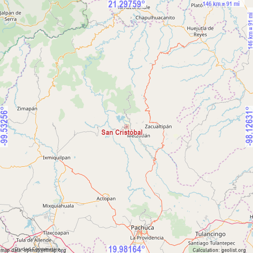
San Cristóbal GPS coordinates[2]
20° 38' 27.744" North, 98° 49' 45.948" West
| Map corner | latitude | longitude |
|---|---|---|
| Upper-left | 21.29759°, | -99.53256° |
| Center: | 20.64104°, | -98.82943° |
| Lower-right: | 19.98164°, | -98.12631° |
| Map W x H: | 146.3×146.3 km | = 90.9×90.9mi |
| max Lat: | 32.7° ⇑29.3% North |
| San Cristóbal: | 20.64104° |
| min Lat: | ⇓70.7% South 14.53588° |
| min Long | San Cristóbal | max Long |
| -117.105° | -98.82943° | -86.73105° |
| W 53.2%⇐ | ⇒46.8% E |
Elevation
Elevation of San Cristóbal is 1332 m = 4370 ft, and this is 78.3 m = 257 ft above average elevation for this country.
| Max E: |
3497 m = 11473 ft | 52.1% |
| San Cristóbal | 1332 m 4370 ft | |
| Avg. | 1253.7 m = 4113 ft | |
Min E: |
-1 m = -3 ft | 47.9% |
See also: Mexico elevation on elevation.city.
Geographical zone
San Cristóbal is located in North Torrid zone (between Equator and Tropic of Cancer). Distance of this Northern Tropic circle is 310.9 km =193.2 mi to North.| Distance of | km | miles | from San Cristóbal |
|---|---|---|---|
| North Pole | 7712 | 4792 | to North |
| Arctic Circle | 5106.1 | 3172.8 | to North |
| Tropic Cancer | 310.9 | 193.2 | to North |
| Equator | 2295.1 | 1426.1 | to South |


Nearby cities:
15 places around San Cristóbal: (largest is in red/bold)
• Alumbres
14.9 km =9.3 mi,  77°
77°
• Eloxochitlán
11.5 km =7.1 mi,  10°
10°
• Fontezuelas
17.5 km =10.9 mi,  194°
194°
• Hualula
7.6 km =4.7 mi,  354°
354°
• La Mojonera
21.8 km =13.5 mi,  94°
94°
• Malila
15.1 km =9.4 mi,  48°
48°
• Metztitlán
8.6 km =5.3 mi,  126°
126°
• Molango
19.3 km =12 mi,  32°
32°
• Nonoalco
15.8 km =9.8 mi,  58°
58°
• Santa Mónica
19.6 km =12.2 mi, 61°
• Tianguistengo
22.7 km =14.1 mi, 64°
• Tlatepexe
6.3 km =3.9 mi, 132°
• Tlaxco
7.5 km =4.7 mi,  15°
15°
• Xochicoatlán
21.7 km =13.5 mi, 45°
• Zacualtipán
18 km =11.2 mi, 86°
Sources, notices
• [Note1] Compared only with cities in Mexico existing in our database
• [Src1] Map data: © OpenStreetMap contributors (CC-BY-SA)
• [Src2] Other city data from geonames.org with taken over terms of usage.
• [Src3] Geographical zone / Annual Mean Temperature by Robert A. Rohde @ Wikipedia
