El Rodeo geodata
El Rodeo (Morelos) is a populated place; located in Mexico in America/Mexico_City (GMT-6) time zone. With population of 1,278 people, there are 6782 cities with bigger population in this country. Compared to other cities in Mexico, 69% of cities are located further ↑North; 54.4% of cities are located further →East and 57.1% of cities have higher elevation than El Rodeo. Note1


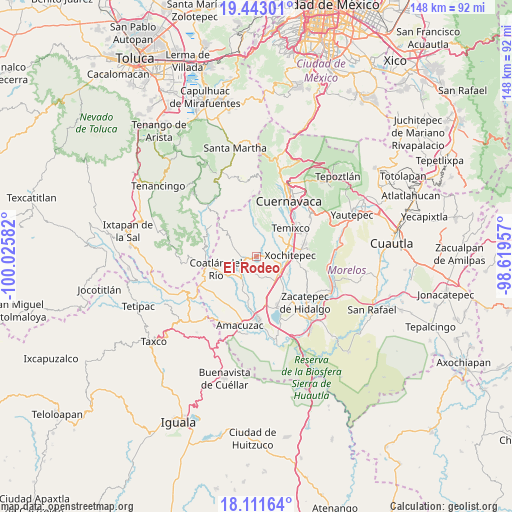
El Rodeo GPS coordinates[2]
18° 46' 43.104" North, 99° 19' 21.684" West
| Map corner | latitude | longitude |
|---|---|---|
| Upper-left | 19.44301°, | -100.02582° |
| Center: | 18.77864°, | -99.32269° |
| Lower-right: | 18.11164°, | -98.61957° |
| Map W x H: | 148×148 km | = 92×92mi |
| max Lat: | 32.7° ⇑69% North |
| El Rodeo: | 18.77864° |
| min Lat: | ⇓31% South 14.53588° |
| min Long | El Rodeo | max Long |
| -117.105° | -99.32269° | -86.73105° |
| W 45.6%⇐ | ⇒54.4% E |
Elevation
Elevation of El Rodeo is 1119 m = 3671 ft, and this is 134.7 m = 442 ft below average elevation for this country.
| Max E: |
3497 m = 11473 ft | 57.1% |
| Avg. | 1253.7 m = 4113 ft | |
| El Rodeo | 1119 m = 3671 ft | |
Min E: |
-1 m = -3 ft | 42.9% |
See also: Mexico elevation on elevation.city.
Geographical zone
El Rodeo is located in North Torrid zone (between Equator and Tropic of Cancer). Distance of this Northern Tropic circle is 517.9 km =321.8 mi to North.| Distance of | km | miles | from El Rodeo |
|---|---|---|---|
| North Pole | 7919.1 | 4920.7 | to North |
| Arctic Circle | 5313.2 | 3301.5 | to North |
| Tropic Cancer | 517.9 | 321.8 | to North |
| Equator | 2088 | 1297.4 | to South |


Nearby cities:
15 places around El Rodeo: (largest is in red/bold)
• Alpuyeca
7.9 km =4.9 mi,  122°
122°
• Benito Juárez (La Monera)
6.9 km =4.3 mi,  56°
56°
• Coatetelco
5.5 km =3.4 mi,  183°
183°
• Colonia Ampliación 3 de Mayo
8.5 km =5.3 mi, 117°
• Colonia Vista Hermosa
4 km =2.5 mi,  233°
233°
• Colonia el Florido
6.5 km =4 mi, 226°
• Colonia la Pintora
9.4 km =5.8 mi,  132°
132°
• Cuentepec
9.2 km =5.7 mi,  357°
357°
• El Mirador
2.1 km =1.3 mi,  247°
247°
• Francisco Villa
8.2 km =5.1 mi,  83°
83°
• Mazatepec
7.1 km =4.4 mi,  217°
217°
• Miacatlán
4.3 km =2.7 mi,  244°
244°
• Santa Cruz Vista Alegre
8.3 km =5.2 mi, 228°
• Unidad Habitacional José María Morelos y Pavón
7.9 km =4.9 mi,  53°
53°
• Xochicalco (Cirenio Longares)
2.6 km =1.6 mi,  68°
68°
Sources, notices
• [Note1] Compared only with cities in Mexico existing in our database
• [Src1] Map data: © OpenStreetMap contributors (CC-BY-SA)
• [Src2] Other city data from geonames.org with taken over terms of usage.
• [Src3] Geographical zone / Annual Mean Temperature by Robert A. Rohde @ Wikipedia
