Contla geodata
Contla (Tlaxcala) is a seat of a second-order administrative division; located in Mexico in America/Mexico_City (GMT-6) time zone. With population of 27,610 people, there are 362 cities with bigger population in this country. Compared to other cities in Mexico, 58.1% of cities are located further ↑North; 61.7% of cities are located further ←West and 87.5% of cities have lower elevation than Contla. Note1


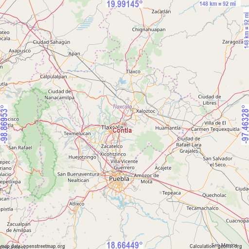
Contla GPS coordinates[2]
19° 19' 45.552" North, 98° 9' 59.04" West
| Map corner | latitude | longitude |
|---|---|---|
| Upper-left | 19.99145°, | -98.86953° |
| Center: | 19.32932°, | -98.1664° |
| Lower-right: | 18.66449°, | -97.46328° |
| Map W x H: | 147.5×147.5 km | = 91.7×91.7mi |
| max Lat: | 32.7° ⇑58.1% North |
| Contla: | 19.32932° |
| min Lat: | ⇓41.9% South 14.53588° |
| min Long | Contla | max Long |
| -117.105° | -98.1664° | -86.73105° |
| W 61.7%⇐ | ⇒38.3% E |
Elevation
Elevation of Contla is 2327 m = 7635 ft, and this is 1073.3 m = 3521 ft above average elevation for this country.
| Max E: |
3497 m = 11473 ft | 12.5% |
| Contla | 2327 m 7635 ft | |
| Avg. | 1253.7 m = 4113 ft | |
Min E: |
-1 m = -3 ft | 87.5% |
See also: Mexico elevation on elevation.city.
Geographical zone
Contla is located in North Torrid zone (between Equator and Tropic of Cancer). Distance of this Northern Tropic circle is 456.7 km =283.8 mi to North.| Distance of | km | miles | from Contla |
|---|---|---|---|
| North Pole | 7857.8 | 4882.6 | to North |
| Arctic Circle | 5252 | 3263.4 | to North |
| Tropic Cancer | 456.7 | 283.8 | to North |
| Equator | 2149.2 | 1335.5 | to South |


Nearby cities:
15 places around Contla: (largest is in red/bold)
• Amaxac de Guerrero
2 km =1.2 mi,  347°
347°
• Apetatitlán Antonio Carbajal
1.5 km =0.9 mi,  299°
299°
• Belén Atzitzimititlán
3.2 km =2 mi,  308°
308°
• Ixtlahuaca
2.9 km =1.8 mi,  118°
118°
• Jesús Huitznahuac
4.3 km =2.7 mi,  69°
69°
• San Bartolomé Cuahuixmatlac
4.4 km =2.7 mi,  154°
154°
• San Lucas Tlacochcalco
2.6 km =1.6 mi,  54°
54°
• San Matías Tepetomatitlán
4.1 km =2.5 mi, 312°
• San Pedro Xochiteotla
3.8 km =2.4 mi,  129°
129°
• Santa Ana Chiautempan
3.4 km =2.1 mi,  221°
221°
• Santa Cruz Tlaxcala
3.3 km =2.1 mi,  30°
30°
• Santa María Aquiáhuac
4 km =2.5 mi,  101°
101°
• Tecolotla
2.3 km =1.4 mi, 296°
• Tlatempan
3.9 km =2.4 mi,  273°
273°
• Tlaxcala
3.7 km =2.3 mi,  251°
251°
Sources, notices
• [Note1] Compared only with cities in Mexico existing in our database
• [Src1] Map data: © OpenStreetMap contributors (CC-BY-SA)
• [Src2] Other city data from geonames.org with taken over terms of usage.
• [Src3] Geographical zone / Annual Mean Temperature by Robert A. Rohde @ Wikipedia
