San Juan Coajomulco geodata
San Juan Coajomulco (State of Mexico) is a populated place; located in Mexico in America/Mexico_City (GMT-6) time zone. With population of 5,137 people, there are 1807 cities with bigger population in this country. Compared to other cities in Mexico, 51.6% of cities are located further ↓South; 63.6% of cities are located further →East and 96.5% of cities have lower elevation than San Juan Coajomulco. Note1


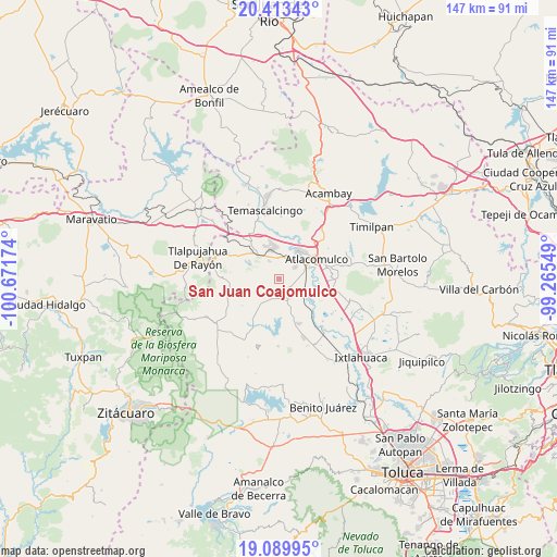
San Juan Coajomulco GPS coordinates[2]
19° 45' 11.016" North, 99° 58' 6.996" West
| Map corner | latitude | longitude |
|---|---|---|
| Upper-left | 20.41343°, | -100.67174° |
| Center: | 19.75306°, | -99.96861° |
| Lower-right: | 19.08995°, | -99.26549° |
| Map W x H: | 147.2×147.2 km | = 91.5×91.5mi |
| max Lat: | 32.7° ⇑48.4% North |
| San Juan Coajomulco: | 19.75306° |
| min Lat: | ⇓51.6% South 14.53588° |
| min Long | San Juan Coajom | max Long |
| -117.105° | -99.96861° | -86.73105° |
| W 36.4%⇐ | ⇒63.6% E |
Elevation
Elevation of San Juan Coajomulco is 2651 m = 8698 ft, and this is 1397.3 m = 4584 ft above average elevation for this country.
| Max E: |
3497 m = 11473 ft | 3.5% |
| San Juan Coajomulco | 2651 m 8698 ft | |
| Avg. | 1253.7 m = 4113 ft | |
Min E: |
-1 m = -3 ft | 96.5% |
See also: Mexico elevation on elevation.city.
Geographical zone
San Juan Coajomulco is located in North Torrid zone (between Equator and Tropic of Cancer). Distance of this Northern Tropic circle is 409.6 km =254.5 mi to North.| Distance of | km | miles | from San Juan Coajomulco |
|---|---|---|---|
| North Pole | 7810.7 | 4853.3 | to North |
| Arctic Circle | 5204.8 | 3234.1 | to North |
| Tropic Cancer | 409.6 | 254.5 | to North |
| Equator | 2196.3 | 1364.7 | to South |


Nearby cities:
15 places around San Juan Coajomulco: (largest is in red/bold)
• Adolfo López Mateos
6.3 km =3.9 mi,  327°
327°
• Barrio San Francisco Ejido de San Pablo Tlalchichilpa
4.7 km =2.9 mi,  245°
245°
• Barrio Santa Cruz de San Pablo Tlalchichilpa
5.1 km =3.2 mi,  196°
196°
• Calvario Buenavista
5.6 km =3.5 mi,  167°
167°
• Cuendo
5.7 km =3.5 mi,  22°
22°
• Ejido del Tunal Nenaxi
6.3 km =3.9 mi,  99°
99°
• El Obraje
3.4 km =2.1 mi, 169°
• La Cabecera Concepción
6.2 km =3.9 mi,  152°
152°
• La Jordana
5.5 km =3.4 mi, 329°
• Pueblo Nuevo de los Ángeles
4.9 km =3 mi,  301°
301°
• San Felipe del Progreso
4.6 km =2.9 mi,  157°
157°
• San Miguel Tenochtitlán
4.9 km =3 mi,  80°
80°
• Santa María Citendejé
5.3 km =3.3 mi,  52°
52°
• Santiago Casandeje
1.9 km =1.2 mi,  358°
358°
• Santiago Citendejé
5.2 km =3.2 mi, 52°
Sources, notices
• [Note1] Compared only with cities in Mexico existing in our database
• [Src1] Map data: © OpenStreetMap contributors (CC-BY-SA)
• [Src2] Other city data from geonames.org with taken over terms of usage.
• [Src3] Geographical zone / Annual Mean Temperature by Robert A. Rohde @ Wikipedia
