Chicontepec geodata
Chicontepec (Veracruz) is a seat of a second-order administrative division; located in Mexico in America/Mexico_City (GMT-6) time zone. With population of 4,519 people, there are 2034 cities with bigger population in this country. Compared to other cities in Mexico, 76.1% of cities are located further ↓South; 61.6% of cities are located further ←West and 68% of cities have higher elevation than Chicontepec. Note1


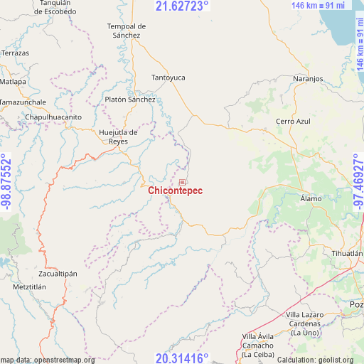
Chicontepec GPS coordinates[2]
20° 58' 19.704" North, 98° 10' 20.604" West
| Map corner | latitude | longitude |
|---|---|---|
| Upper-left | 21.62723°, | -98.87552° |
| Center: | 20.97214°, | -98.17239° |
| Lower-right: | 20.31416°, | -97.46927° |
| Map W x H: | 146×146 km | = 90.7×90.7mi |
| max Lat: | 32.7° ⇑23.9% North |
| Chicontepec: | 20.97214° |
| min Lat: | ⇓76.1% South 14.53588° |
| min Long | Chicontepec | max Long |
| -117.105° | -98.17239° | -86.73105° |
| W 61.6%⇐ | ⇒38.4% E |
Elevation
Elevation of Chicontepec is 530 m = 1739 ft, and this is 723.7 m = 2374 ft below average elevation for this country.
| Max E: |
3497 m = 11473 ft | 68% |
| Avg. | 1253.7 m = 4113 ft | |
| Chicontepec | 530 m = 1739 ft | |
Min E: |
-1 m = -3 ft | 32% |
See also: Mexico elevation on elevation.city.
Geographical zone
Chicontepec is located in North Torrid zone (between Equator and Tropic of Cancer). Distance of this Northern Tropic circle is 274 km =170.3 mi to North.| Distance of | km | miles | from Chicontepec |
|---|---|---|---|
| North Pole | 7675.2 | 4769.1 | to North |
| Arctic Circle | 5069.3 | 3149.9 | to North |
| Tropic Cancer | 274 | 170.3 | to North |
| Equator | 2331.9 | 1449 | to South |


Nearby cities:
15 places around Chicontepec: (largest is in red/bold)
• Acatepec
10.7 km =6.6 mi,  258°
258°
• Acatipa
11.3 km =7 mi,  237°
237°
• Acatitla
2.9 km =1.8 mi,  232°
232°
• Ahuateno
4.1 km =2.5 mi,  33°
33°
• Ahuatitla
5 km =3.1 mi, 259°
• Ahuica
4.6 km =2.9 mi,  186°
186°
• Alahualtitla
5 km =3.1 mi,  173°
173°
• Benito Juárez
10.2 km =6.3 mi,  200°
200°
• Calaco
9.6 km =6 mi, 188°
• Huazalinguillo
8.2 km =5.1 mi,  285°
285°
• Huizache Achichipic
3.6 km =2.2 mi,  110°
110°
• Pemuxtitla
7.3 km =4.5 mi,  164°
164°
• Sasaltitla
4.8 km =3 mi,  211°
211°
• Tamoyón I
9.7 km =6 mi,  306°
306°
• Texoloc
10.4 km =6.5 mi, 234°
Sources, notices
• [Note1] Compared only with cities in Mexico existing in our database
• [Src1] Map data: © OpenStreetMap contributors (CC-BY-SA)
• [Src2] Other city data from geonames.org with taken over terms of usage.
• [Src3] Geographical zone / Annual Mean Temperature by Robert A. Rohde @ Wikipedia
