San Francisco Jayacaxtepec geodata
San Francisco Jayacaxtepec (Oaxaca) is a populated place; located in Mexico in America/Mexico_City (GMT-6) time zone. With population of 816 people, there are 10702 cities with bigger population in this country. Compared to other cities in Mexico, 86.3% of cities are located further ↑North; 82.3% of cities are located further ←West and 54.2% of cities have lower elevation than San Francisco Jayacaxtepec. Note1
Current local time in San Francisco Jayacaxtepec:
08:35 AM, WednesdayDifference from your time zone: hours


San Francisco Jayacaxtepec GPS coordinates[2]
17° 13' 18.012" North, 95° 58' 28.992" West
| Map corner | latitude | longitude |
|---|---|---|
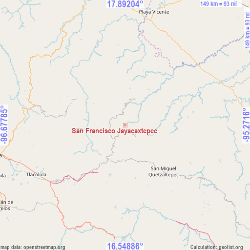
| Upper-left | 17.89204°, | -96.67785° |
| Center: | 17.22167°, | -95.97472° |
| Lower-right: | 16.54886°, | -95.2716° |
| Map W x H: | 149.3×149.3 km | = 92.8×92.8mi |
| max Lat: | 32.7° ⇑86.3% North |
| San Francisco Jayacaxtepec: | 17.22167° |
| min Lat: | ⇓13.7% South 14.53588° |
| min Long | San Francisco J | max Long |
| -117.105° | -95.97472° | -86.73105° |
| W 82.3%⇐ | ⇒17.7% E |
Elevation
Elevation of San Francisco Jayacaxtepec is 1566 m = 5138 ft, and this is 312.3 m = 1025 ft above average elevation for this country.
| Max E: |
3497 m = 11473 ft | 45.8% |
| San Francisco Jayacaxtepec | 1566 m 5138 ft | |
| Avg. | 1253.7 m = 4113 ft | |
Min E: |
-1 m = -3 ft | 54.2% |
See also: Mexico elevation on elevation.city.
Geographical zone
San Francisco Jayacaxtepec is located in North Torrid zone (between Equator and Tropic of Cancer). Distance of this Northern Tropic circle is 691 km =429.4 mi to North.| Distance of | km | miles | from San Francisco Jayacaxtepec |
|---|---|---|---|
| North Pole | 8092.2 | 5028.3 | to North |
| Arctic Circle | 5486.3 | 3409 | to North |
| Tropic Cancer | 691 | 429.4 | to North |
| Equator | 1914.9 | 1189.9 | to South |


Nearby cities:
15 places around San Francisco Jayacaxtepec: (largest is in red/bold)
• Chichicaxtepec
14 km =8.7 mi,  243°
243°
• Chinantequilla
10 km =6.2 mi,  345°
345°
• La Candelaria
4.4 km =2.7 mi,  94°
94°
• Lachixova
10.6 km =6.6 mi,  5°
5°
• Mixistlán
16 km =9.9 mi, 235°
• San Juan Metaltepec
8.4 km =5.2 mi,  127°
127°
• San Pedro Ayacaxtepec
15.2 km =9.4 mi,  138°
138°
• Santa Ana
16.4 km =10.2 mi,  211°
211°
• Santa María Tiltepec
13 km =8.1 mi,  275°
275°
• Santiago Altitlán
13.4 km =8.3 mi,  166°
166°
• Santiago Choápam
16.4 km =10.2 mi,  19°
19°
• Santiago Tepitongo
10.7 km =6.6 mi,  325°
325°
• Santiago Zacatepec
9.4 km =5.8 mi, 136°
• Totontepec Villa de Morelos
6.9 km =4.3 mi,  304°
304°
• Yacochi
12.1 km =7.5 mi,  221°
221°
Sources, notices
• [Note1] Compared only with cities in Mexico existing in our database
• [Src1] Map data: © OpenStreetMap contributors (CC-BY-SA)
• [Src2] Other city data from geonames.org with taken over terms of usage.
• [Src3] Geographical zone / Annual Mean Temperature by Robert A. Rohde @ Wikipedia
