Chahuapan geodata
Chahuapan (Veracruz) is a populated place; located in Mexico in America/Mexico_City (GMT-6) time zone. With population of 824 people, there are 10606 cities with bigger population in this country. Compared to other cities in Mexico, 57.7% of cities are located further ↑North; 78.5% of cities are located further ←West and 68.2% of cities have higher elevation than Chahuapan. Note1


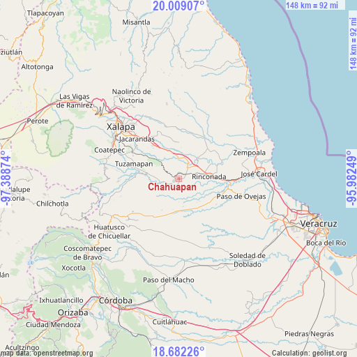
Chahuapan GPS coordinates[2]
19° 20' 49.236" North, 96° 41' 8.196" West
| Map corner | latitude | longitude |
|---|---|---|
| Upper-left | 20.00907°, | -97.38874° |
| Center: | 19.34701°, | -96.68561° |
| Lower-right: | 18.68226°, | -95.98249° |
| Map W x H: | 147.5×147.5 km | = 91.7×91.7mi |
| max Lat: | 32.7° ⇑57.7% North |
| Chahuapan: | 19.34701° |
| min Lat: | ⇓42.3% South 14.53588° |
| min Long | Chahuapan | max Long |
| -117.105° | -96.68561° | -86.73105° |
| W 78.5%⇐ | ⇒21.5% E |
Elevation
Elevation of Chahuapan is 520 m = 1706 ft, and this is 733.7 m = 2407 ft below average elevation for this country.
| Max E: |
3497 m = 11473 ft | 68.2% |
| Avg. | 1253.7 m = 4113 ft | |
| Chahuapan | 520 m = 1706 ft | |
Min E: |
-1 m = -3 ft | 31.8% |
See also: Mexico elevation on elevation.city.
Geographical zone
Chahuapan is located in North Torrid zone (between Equator and Tropic of Cancer). Distance of this Northern Tropic circle is 454.7 km =282.5 mi to North.| Distance of | km | miles | from Chahuapan |
|---|---|---|---|
| North Pole | 7855.9 | 4881.4 | to North |
| Arctic Circle | 5250 | 3262.2 | to North |
| Tropic Cancer | 454.7 | 282.5 | to North |
| Equator | 2151.2 | 1336.7 | to South |


Nearby cities:
15 places around Chahuapan: (largest is in red/bold)
• Agua Caliente
5.2 km =3.2 mi,  125°
125°
• Apazapan
4.5 km =2.8 mi,  229°
229°
• Cerro Colorado (Estación Apazapán)
2.4 km =1.5 mi,  286°
286°
• Cerro Gordo
9.7 km =6 mi,  350°
350°
• El Aguaje
10.6 km =6.6 mi,  42°
42°
• El Roble
8.8 km =5.5 mi,  324°
324°
• Hato de la Higuera
11.7 km =7.3 mi,  171°
171°
• Jalcomulco
8.2 km =5.1 mi,  258°
258°
• Palo Gacho
7.1 km =4.4 mi,  46°
46°
• Paso de la Milpa
11.7 km =7.3 mi, 40°
• Plan del Río
7 km =4.3 mi,  29°
29°
• Rinconada
12.6 km =7.8 mi,  86°
86°
• Santa María Tatetla
8.7 km =5.4 mi,  198°
198°
• Tigrillos
2.6 km =1.6 mi, 354°
• Villa Emiliano Zapata
3.5 km =2.2 mi,  57°
57°
Sources, notices
• [Note1] Compared only with cities in Mexico existing in our database
• [Src1] Map data: © OpenStreetMap contributors (CC-BY-SA)
• [Src2] Other city data from geonames.org with taken over terms of usage.
• [Src3] Geographical zone / Annual Mean Temperature by Robert A. Rohde @ Wikipedia
