Palo Gacho geodata
Palo Gacho (Veracruz) is a populated place; located in Mexico in America/Mexico_City (GMT-6) time zone. With population of 1,378 people, there are 6291 cities with bigger population in this country. Compared to other cities in Mexico, 56.5% of cities are located further ↑North; 78.9% of cities are located further ←West and 71.6% of cities have higher elevation than Palo Gacho. Note1


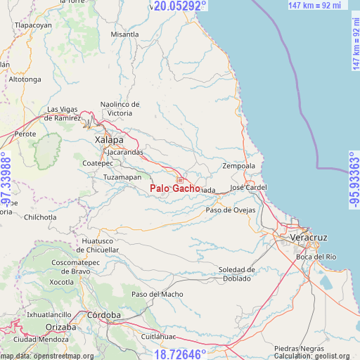
Palo Gacho GPS coordinates[2]
19° 23' 27.744" North, 96° 38' 12.3" West
| Map corner | latitude | longitude |
|---|---|---|
| Upper-left | 20.05292°, | -97.33988° |
| Center: | 19.39104°, | -96.63675° |
| Lower-right: | 18.72646°, | -95.93363° |
| Map W x H: | 147.5×147.5 km | = 91.7×91.7mi |
| max Lat: | 32.7° ⇑56.5% North |
| Palo Gacho: | 19.39104° |
| min Lat: | ⇓43.5% South 14.53588° |
| min Long | Palo Gacho | max Long |
| -117.105° | -96.63675° | -86.73105° |
| W 78.9%⇐ | ⇒21.1% E |
Elevation
Elevation of Palo Gacho is 344 m = 1129 ft, and this is 909.7 m = 2985 ft below average elevation for this country.
| Max E: |
3497 m = 11473 ft | 71.6% |
| Avg. | 1253.7 m = 4113 ft | |
| Palo Gacho | 344 m = 1129 ft | |
Min E: |
-1 m = -3 ft | 28.4% |
See also: Mexico elevation on elevation.city.
Geographical zone
Palo Gacho is located in North Torrid zone (between Equator and Tropic of Cancer). Distance of this Northern Tropic circle is 449.8 km =279.5 mi to North.| Distance of | km | miles | from Palo Gacho |
|---|---|---|---|
| North Pole | 7851 | 4878.4 | to North |
| Arctic Circle | 5245.1 | 3259.2 | to North |
| Tropic Cancer | 449.8 | 279.5 | to North |
| Equator | 2156.1 | 1339.7 | to South |


Nearby cities:
15 places around Palo Gacho: (largest is in red/bold)
• Agua Caliente
8 km =5 mi,  186°
186°
• Apazapan
11.6 km =7.2 mi,  227°
227°
• Buena Vista
8.3 km =5.2 mi,  80°
80°
• Cerro Colorado (Estación Apazapán)
8.5 km =5.3 mi,  240°
240°
• Cerro Gordo
8.2 km =5.1 mi,  305°
305°
• Chahuapan
7.1 km =4.4 mi, 226°
• El Aguaje
3.6 km =2.2 mi,  35°
35°
• El Roble
10.5 km =6.5 mi,  282°
282°
• La Esperanza
12.6 km =7.8 mi, 39°
• Los Ídolos
12.7 km =7.9 mi, 79°
• Paso de la Milpa
4.7 km =2.9 mi,  31°
31°
• Plan del Río
2 km =1.2 mi, 306°
• Rinconada
8.5 km =5.3 mi,  118°
118°
• Tigrillos
5.9 km =3.7 mi,  246°
246°
• Villa Emiliano Zapata
3.8 km =2.4 mi,  215°
215°
Sources, notices
• [Note1] Compared only with cities in Mexico existing in our database
• [Src1] Map data: © OpenStreetMap contributors (CC-BY-SA)
• [Src2] Other city data from geonames.org with taken over terms of usage.
• [Src3] Geographical zone / Annual Mean Temperature by Robert A. Rohde @ Wikipedia
