San Miguel Cerezo (El Cerezo) geodata
San Miguel Cerezo (El Cerezo) (Hidalgo) is a populated place; located in Mexico in America/Mexico_City (GMT-6) time zone. With population of 1,981 people, there are 4398 cities with bigger population in this country. Compared to other cities in Mexico, 60.4% of cities are located further ↓South; 54.7% of cities are located further ←West and 97% of cities have lower elevation than San Miguel Cerezo (El Cerezo). Note1
Current local time in San Miguel Cerezo (El Cerezo):
11:18 AM, MondayDifference from your time zone: hours


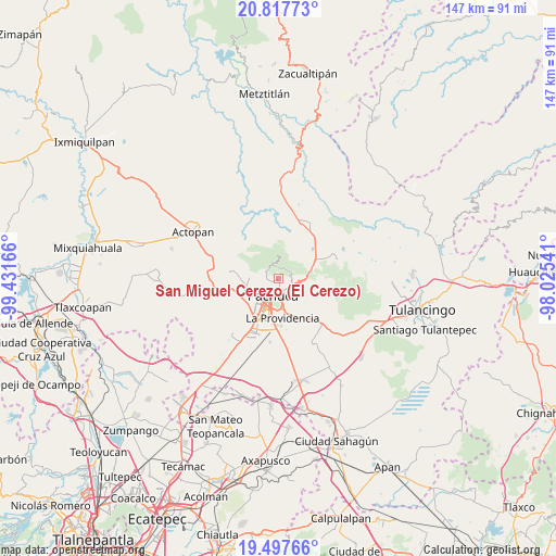
San Miguel Cerezo (El Cerezo) GPS coordinates[2]
20° 9' 32.724" North, 98° 43' 42.708" West
| Map corner | latitude | longitude |
|---|---|---|
| Upper-left | 20.81773°, | -99.43166° |
| Center: | 20.15909°, | -98.72853° |
| Lower-right: | 19.49766°, | -98.02541° |
| Map W x H: | 146.8×146.8 km | = 91.2×91.2mi |
| max Lat: | 32.7° ⇑39.6% North |
| San Miguel Cerezo (El Cerezo): | 20.15909° |
| min Lat: | ⇓60.4% South 14.53588° |
| min Long | San Miguel Cere | max Long |
| -117.105° | -98.72853° | -86.73105° |
| W 54.7%⇐ | ⇒45.3% E |
Elevation
Elevation of San Miguel Cerezo (El Cerezo) is 2677 m = 8783 ft, and this is 1423.3 m = 4670 ft above average elevation for this country.
| Max E: |
3497 m = 11473 ft | 3% |
| San Miguel Cerezo (El Cerezo) | 2677 m 8783 ft | |
| Avg. | 1253.7 m = 4113 ft | |
Min E: |
-1 m = -3 ft | 97% |
See also: Mexico elevation on elevation.city.
Geographical zone
San Miguel Cerezo (El Cerezo) is located in North Torrid zone (between Equator and Tropic of Cancer). Distance of this Northern Tropic circle is 364.4 km =226.4 mi to North.| Distance of | km | miles | from San Miguel Cerezo (El Cerezo) |
|---|---|---|---|
| North Pole | 7765.6 | 4825.3 | to North |
| Arctic Circle | 5159.7 | 3206.1 | to North |
| Tropic Cancer | 364.4 | 226.4 | to North |
| Equator | 2241.5 | 1392.8 | to South |


Nearby cities:
15 places around San Miguel Cerezo (El Cerezo): (largest is in red/bold)
• Camelia (Barrio la Camelia)
1.3 km =0.8 mi,  149°
149°
• Colonia Militar
5.9 km =3.7 mi, 153°
• Guadalupe Minerva
4 km =2.5 mi,  157°
157°
• La Estanzuela
3.7 km =2.3 mi,  305°
305°
• Manuel Ávila Camacho
5.7 km =3.5 mi, 156°
• Mineral del Monte
6.2 km =3.9 mi,  111°
111°
• Pachuca de Soto
4.7 km =2.9 mi,  186°
186°
• Pueblo Nuevo
4.3 km =2.7 mi,  68°
68°
• Real de Oriente
5.9 km =3.7 mi,  176°
176°
• Rio de la Soledad
5.2 km =3.2 mi, 160°
• San Guillermo la Reforma
5.3 km =3.3 mi,  144°
144°
• Santiago Jaltepec
5.8 km =3.6 mi, 161°
• Unidad Habitacional CTM
6.6 km =4.1 mi,  172°
172°
• Unidad Minera 11 de Julio
6.1 km =3.8 mi, 174°
• Álamo Rustico
6.6 km =4.1 mi, 168°
Sources, notices
• [Note1] Compared only with cities in Mexico existing in our database
• [Src1] Map data: © OpenStreetMap contributors (CC-BY-SA)
• [Src2] Other city data from geonames.org with taken over terms of usage.
• [Src3] Geographical zone / Annual Mean Temperature by Robert A. Rohde @ Wikipedia
