La Estanzuela geodata
La Estanzuela (Hidalgo) is a populated place; located in Mexico in America/Mexico_City (GMT-6) time zone. With population of 1,847 people, there are 4702 cities with bigger population in this country. Compared to other cities in Mexico, 60.9% of cities are located further ↓South; 54.3% of cities are located further ←West and 98.3% of cities have lower elevation than La Estanzuela. Note1


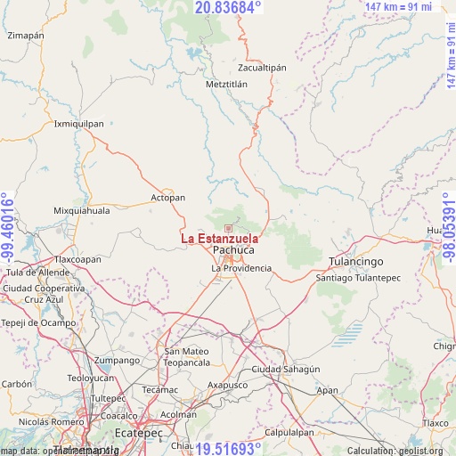
La Estanzuela GPS coordinates[2]
20° 10' 41.808" North, 98° 45' 25.308" West
| Map corner | latitude | longitude |
|---|---|---|
| Upper-left | 20.83684°, | -99.46016° |
| Center: | 20.17828°, | -98.75703° |
| Lower-right: | 19.51693°, | -98.05391° |
| Map W x H: | 146.8×146.8 km | = 91.2×91.2mi |
| max Lat: | 32.7° ⇑39.1% North |
| La Estanzuela: | 20.17828° |
| min Lat: | ⇓60.9% South 14.53588° |
| min Long | La Estanzuela | max Long |
| -117.105° | -98.75703° | -86.73105° |
| W 54.3%⇐ | ⇒45.7% E |
Elevation
Elevation of La Estanzuela is 2769 m = 9085 ft, and this is 1515.3 m = 4971 ft above average elevation for this country.
| Max E: |
3497 m = 11473 ft | 1.7% |
| La Estanzuela | 2769 m 9085 ft | |
| Avg. | 1253.7 m = 4113 ft | |
Min E: |
-1 m = -3 ft | 98.3% |
See also: Mexico elevation on elevation.city.
Geographical zone
La Estanzuela is located in North Torrid zone (between Equator and Tropic of Cancer). Distance of this Northern Tropic circle is 362.3 km =225.1 mi to North.| Distance of | km | miles | from La Estanzuela |
|---|---|---|---|
| North Pole | 7763.4 | 4824 | to North |
| Arctic Circle | 5157.6 | 3204.8 | to North |
| Tropic Cancer | 362.3 | 225.1 | to North |
| Equator | 2243.6 | 1394.1 | to South |


Nearby cities:
15 places around La Estanzuela: (largest is in red/bold)
• Banús
7.3 km =4.5 mi,  224°
224°
• Benito Juárez
7.5 km =4.7 mi,  254°
254°
• Camelia (Barrio la Camelia)
4.9 km =3 mi,  131°
131°
• Carboneras
7.6 km =4.7 mi,  58°
58°
• Guadalupe Minerva
7.4 km =4.6 mi,  142°
142°
• Manuel Ávila Camacho
9 km =5.6 mi, 144°
• Pachuca de Soto
7.3 km =4.5 mi,  160°
160°
• Pueblo Nuevo
7 km =4.3 mi,  94°
94°
• Real de Oriente
8.7 km =5.4 mi, 157°
• Rio de la Soledad
8.5 km =5.3 mi,  146°
146°
• San Guillermo la Reforma
8.9 km =5.5 mi, 136°
• San Juan Tilcuautla
5.1 km =3.2 mi,  244°
244°
• San Miguel Cerezo (El Cerezo)
3.7 km =2.3 mi, 125°
• Santiago Jaltepec
9 km =5.6 mi, 147°
• Unidad Minera 11 de Julio
8.9 km =5.5 mi, 156°
Sources, notices
• [Note1] Compared only with cities in Mexico existing in our database
• [Src1] Map data: © OpenStreetMap contributors (CC-BY-SA)
• [Src2] Other city data from geonames.org with taken over terms of usage.
• [Src3] Geographical zone / Annual Mean Temperature by Robert A. Rohde @ Wikipedia
