Los Cavazos geodata
Los Cavazos (Tamaulipas) is a populated place; located in Mexico in America/Matamoros (GMT-5) time zone. With population of 2,187 people, there are 4020 cities with bigger population in this country. Compared to other cities in Mexico, 95.5% of cities are located further ↓South; 59.3% of cities are located further ←West and 85% of cities have higher elevation than Los Cavazos. Note1


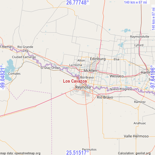
Los Cavazos GPS coordinates[2]
26° 8' 52.908" North, 98° 20' 42.288" West
| Map corner | latitude | longitude |
|---|---|---|
| Upper-left | 26.77748°, | -99.04821° |
| Center: | 26.14803°, | -98.34508° |
| Lower-right: | 25.51517°, | -97.64196° |
| Map W x H: | 140.4×140.4 km | = 87.2×87.2mi |
| max Lat: | 32.7° ⇑4.5% North |
| Los Cavazos: | 26.14803° |
| min Lat: | ⇓95.5% South 14.53588° |
| min Long | Los Cavazos | max Long |
| -117.105° | -98.34508° | -86.73105° |
| W 59.3%⇐ | ⇒40.7% E |
Elevation
Elevation of Los Cavazos is 44 m = 144 ft, and this is 1209.7 m = 3969 ft below average elevation for this country.
| Max E: |
3497 m = 11473 ft | 85% |
| Avg. | 1253.7 m = 4113 ft | |
| Los Cavazos | 44 m = 144 ft | |
Min E: |
-1 m = -3 ft | 15% |
See also: Mexico elevation on elevation.city.
Geographical zone
Los Cavazos is located in North temperate zone (between Tropic of Cancer and the Arctic Circle). Distance of this Northern Tropic circle is 301.5 km =187.3 mi to South.| Distance of | km | miles | from Los Cavazos |
|---|---|---|---|
| North Pole | 7099.7 | 4411.5 | to North |
| Arctic Circle | 4493.8 | 2792.3 | to North |
| Tropic Cancer | 301.5 | 187.3 | to South |
| Equator | 2907.4 | 1806.6 | to South |


Nearby cities:
15 places around Los Cavazos: (largest is in red/bold)
• Ampliación Río Bravo
31.7 km =19.7 mi,  136°
136°
• Argüelles
13.4 km =8.3 mi,  290°
290°
• Brecha 124 con Vía de FFCC
41.4 km =25.7 mi,  114°
114°
• Camargo
51.1 km =31.8 mi,  283°
283°
• Ciudad Camargo
52.1 km =32.4 mi, 290°
• Ciudad Gustavo Díaz Ordaz
26.7 km =16.6 mi, 290°
• Ciudad Río Bravo
30.8 km =19.1 mi,  125°
125°
• Comales
57.5 km =35.7 mi,  273°
273°
• El Control
57.2 km =35.5 mi, 111°
• Ensenada
56.9 km =35.4 mi,  122°
122°
• Hidalgo
18.1 km =11.2 mi, 126°
• Nuevo Progreso
40.6 km =25.2 mi,  104°
104°
• Reynosa
9.4 km =5.8 mi, 142°
• Valadeces
34.4 km =21.4 mi, 285°
• Vamos Tamaulipas
21.8 km =13.5 mi,  145°
145°
Sources, notices
• [Note1] Compared only with cities in Mexico existing in our database
• [Src1] Map data: © OpenStreetMap contributors (CC-BY-SA)
• [Src2] Other city data from geonames.org with taken over terms of usage.
• [Src3] Geographical zone / Annual Mean Temperature by Robert A. Rohde @ Wikipedia
