Camargo geodata
Camargo (Tamaulipas) is a populated place; located in Mexico in America/Monterrey (GMT-6) time zone. With population of 10,085 people, there are 944 cities with bigger population in this country. Compared to other cities in Mexico, 95.6% of cities are located further ↓South; 52.9% of cities are located further ←West and 83.1% of cities have higher elevation than Camargo. Note1


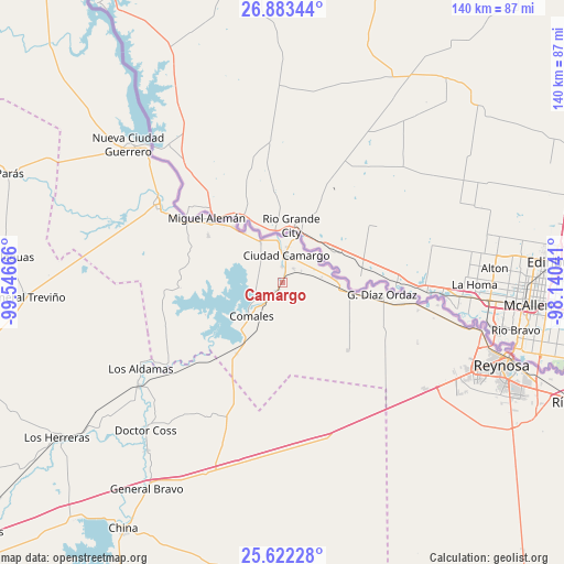
Camargo GPS coordinates[2]
26° 15' 16.452" North, 98° 50' 36.708" West
| Map corner | latitude | longitude |
|---|---|---|
| Upper-left | 26.88344°, | -99.54666° |
| Center: | 26.25457°, | -98.84353° |
| Lower-right: | 25.62228°, | -98.14041° |
| Map W x H: | 140.2×140.2 km | = 87.1×87.1mi |
| max Lat: | 32.7° ⇑4.4% North |
| Camargo: | 26.25457° |
| min Lat: | ⇓95.6% South 14.53588° |
| min Long | Camargo | max Long |
| -117.105° | -98.84353° | -86.73105° |
| W 52.9%⇐ | ⇒47.1% E |
Elevation
Elevation of Camargo is 59 m = 194 ft, and this is 1194.7 m = 3920 ft below average elevation for this country.
| Max E: |
3497 m = 11473 ft | 83.1% |
| Avg. | 1253.7 m = 4113 ft | |
| Camargo | 59 m = 194 ft | |
Min E: |
-1 m = -3 ft | 16.9% |
See also: Mexico elevation on elevation.city.
Geographical zone
Camargo is located in North temperate zone (between Tropic of Cancer and the Arctic Circle). Distance of this Northern Tropic circle is 313.3 km =194.7 mi to South.| Distance of | km | miles | from Camargo |
|---|---|---|---|
| North Pole | 7087.8 | 4404.2 | to North |
| Arctic Circle | 4481.9 | 2784.9 | to North |
| Tropic Cancer | 313.3 | 194.7 | to South |
| Equator | 2919.2 | 1813.9 | to South |


Nearby cities:
15 places around Camargo: (largest is in red/bold)
• Argüelles
37.8 km =23.5 mi,  100°
100°
• Ciudad Camargo
6.7 km =4.2 mi,  8°
8°
• Ciudad Gustavo Díaz Ordaz
24.9 km =15.5 mi, 95°
• Ciudad Miguel Alemán
24.5 km =15.2 mi,  311°
311°
• Comales
11.1 km =6.9 mi,  223°
223°
• Doctor Coss
49.9 km =31 mi, 222°
• General Tapia (Mariano Escobedo)
51.6 km =32.1 mi,  202°
202°
• Los Aldamas
41.1 km =25.5 mi,  238°
238°
• Los Cavazos
51.1 km =31.8 mi, 103°
• Los Guerra
28.2 km =17.5 mi,  303°
303°
• Los Ángeles
20.3 km =12.6 mi, 314°
• Mier
36.4 km =22.6 mi, 302°
• Nueva Ciudad Guerrero
51.4 km =31.9 mi, 311°
• Reynosa
58.7 km =36.5 mi,  109°
109°
• Valadeces
16.8 km =10.4 mi, 98°
Sources, notices
• [Note1] Compared only with cities in Mexico existing in our database
• [Src1] Map data: © OpenStreetMap contributors (CC-BY-SA)
• [Src2] Other city data from geonames.org with taken over terms of usage.
• [Src3] Geographical zone / Annual Mean Temperature by Robert A. Rohde @ Wikipedia
