Valadeces geodata
Valadeces (Tamaulipas) is a populated place; located in Mexico in America/Monterrey (GMT-6) time zone. With population of 2,009 people, there are 4328 cities with bigger population in this country. Compared to other cities in Mexico, 95.6% of cities are located further ↓South; 55.4% of cities are located further ←West and 84.5% of cities have higher elevation than Valadeces. Note1


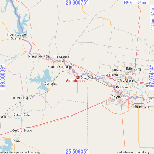
Valadeces GPS coordinates[2]
26° 13' 54.336" North, 98° 40' 38.136" West
| Map corner | latitude | longitude |
|---|---|---|
| Upper-left | 26.86075°, | -99.38039° |
| Center: | 26.23176°, | -98.67726° |
| Lower-right: | 25.59935°, | -97.97414° |
| Map W x H: | 140.3×140.3 km | = 87.2×87.2mi |
| max Lat: | 32.7° ⇑4.4% North |
| Valadeces: | 26.23176° |
| min Lat: | ⇓95.6% South 14.53588° |
| min Long | Valadeces | max Long |
| -117.105° | -98.67726° | -86.73105° |
| W 55.4%⇐ | ⇒44.6% E |
Elevation
Elevation of Valadeces is 48 m = 157 ft, and this is 1205.7 m = 3956 ft below average elevation for this country.
| Max E: |
3497 m = 11473 ft | 84.5% |
| Avg. | 1253.7 m = 4113 ft | |
| Valadeces | 48 m = 157 ft | |
Min E: |
-1 m = -3 ft | 15.5% |
See also: Mexico elevation on elevation.city.
Geographical zone
Valadeces is located in North temperate zone (between Tropic of Cancer and the Arctic Circle). Distance of this Northern Tropic circle is 310.8 km =193.1 mi to South.| Distance of | km | miles | from Valadeces |
|---|---|---|---|
| North Pole | 7090.4 | 4405.8 | to North |
| Arctic Circle | 4484.5 | 2786.5 | to North |
| Tropic Cancer | 310.8 | 193.1 | to South |
| Equator | 2916.7 | 1812.4 | to South |


Nearby cities:
15 places around Valadeces: (largest is in red/bold)
• Argüelles
21.1 km =13.1 mi,  102°
102°
• Camargo
16.8 km =10.4 mi,  278°
278°
• Ciudad Camargo
18.1 km =11.2 mi,  300°
300°
• Ciudad Gustavo Díaz Ordaz
8.1 km =5 mi,  89°
89°
• Ciudad Miguel Alemán
39.7 km =24.7 mi, 298°
• Comales
24.9 km =15.5 mi,  257°
257°
• General Tapia (Mariano Escobedo)
57.9 km =36 mi,  218°
218°
• Hidalgo
51.7 km =32.1 mi,  112°
112°
• Los Aldamas
55.1 km =34.2 mi,  249°
249°
• Los Cavazos
34.4 km =21.4 mi, 105°
• Los Guerra
44 km =27.3 mi,  294°
294°
• Los Ángeles
35.3 km =21.9 mi, 298°
• Mier
52.2 km =32.4 mi, 294°
• Reynosa
42.3 km =26.3 mi, 113°
• Vamos Tamaulipas
53 km =32.9 mi,  120°
120°
Sources, notices
• [Note1] Compared only with cities in Mexico existing in our database
• [Src1] Map data: © OpenStreetMap contributors (CC-BY-SA)
• [Src2] Other city data from geonames.org with taken over terms of usage.
• [Src3] Geographical zone / Annual Mean Temperature by Robert A. Rohde @ Wikipedia
