General Tapia (Mariano Escobedo) geodata
General Tapia (Mariano Escobedo) (Nuevo León) is a populated place; located in Mexico in America/Monterrey (GMT-6) time zone. With population of 565 people, there are 15122 cities with bigger population in this country. Compared to other cities in Mexico, 94.4% of cities are located further ↓South; 50.4% of cities are located further →East and 78.6% of cities have higher elevation than General Tapia (Mariano Escobedo). Note1
Current local time in General Tapia (Mariano Escobedo):
08:44 AM, MondayDifference from your time zone: hours


General Tapia (Mariano Escobedo) GPS coordinates[2]
25° 49' 32.016" North, 99° 2' 22.992" West
| Map corner | latitude | longitude |
|---|---|---|
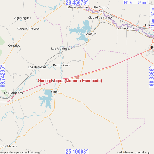
| Upper-left | 26.45676°, | -99.74285° |
| Center: | 25.82556°, | -99.03972° |
| Lower-right: | 25.19098°, | -98.3366° |
| Map W x H: | 140.7×140.7 km | = 87.4×87.4mi |
| max Lat: | 32.7° ⇑5.6% North |
| General Tapia (Mariano Escobedo): | 25.82556° |
| min Lat: | ⇓94.4% South 14.53588° |
| min Long | General Tapia ( | max Long |
| -117.105° | -99.03972° | -86.73105° |
| W 49.6%⇐ | ⇒50.4% E |
Elevation
Elevation of General Tapia (Mariano Escobedo) is 119 m = 390 ft, and this is 1134.7 m = 3723 ft below average elevation for this country.
| Max E: |
3497 m = 11473 ft | 78.6% |
| Avg. | 1253.7 m = 4113 ft | |
| General Tapia (Mariano Escobedo) | 119 m = 390 ft | |
Min E: |
-1 m = -3 ft | 21.4% |
See also: Mexico elevation on elevation.city.
Geographical zone
General Tapia (Mariano Escobedo) is located in North temperate zone (between Tropic of Cancer and the Arctic Circle). Distance of this Northern Tropic circle is 265.6 km =165 mi to South.| Distance of | km | miles | from General Tapia (Mariano Escobedo) |
|---|---|---|---|
| North Pole | 7135.5 | 4433.8 | to North |
| Arctic Circle | 4529.6 | 2814.6 | to North |
| Tropic Cancer | 265.6 | 165 | to South |
| Equator | 2871.5 | 1784.3 | to South |


Nearby cities:
15 places around General Tapia (Mariano Escobedo): (largest is in red/bold)
• Camargo
51.6 km =32.1 mi,  22°
22°
• China
24 km =14.9 mi,  234°
234°
• Ciudad Camargo
58.1 km =36.1 mi, 20°
• Ciudad Gustavo Díaz Ordaz
63.3 km =39.3 mi,  44°
44°
• Comales
41.4 km =25.7 mi, 16°
• Doctor Coss
18.1 km =11.2 mi,  307°
307°
• General Bravo
14.7 km =9.1 mi,  255°
255°
• General Treviño
62.7 km =39 mi, 314°
• Los Aldamas
30.6 km =19 mi,  329°
329°
• Los Guerra
63.4 km =39.4 mi,  356°
356°
• Los Herreras
37.7 km =23.4 mi,  284°
284°
• Los Ramones
60.4 km =37.5 mi, 256°
• Los Ángeles
62.1 km =38.6 mi,  4°
4°
• Melchor Ocampo
56.5 km =35.1 mi,  296°
296°
• Valadeces
57.9 km =36 mi, 38°
Sources, notices
• [Note1] Compared only with cities in Mexico existing in our database
• [Src1] Map data: © OpenStreetMap contributors (CC-BY-SA)
• [Src2] Other city data from geonames.org with taken over terms of usage.
• [Src3] Geographical zone / Annual Mean Temperature by Robert A. Rohde @ Wikipedia
