Cacalotenango geodata
Cacalotenango (Guerrero) is a populated place; located in Mexico in America/Mexico_City (GMT-6) time zone. With population of 1,877 people, there are 4633 cities with bigger population in this country. Compared to other cities in Mexico, 72% of cities are located further ↑North; 59.3% of cities are located further →East and 55.6% of cities have lower elevation than Cacalotenango. Note1


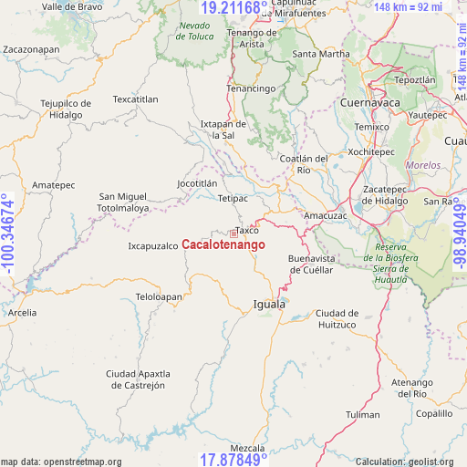
Cacalotenango GPS coordinates[2]
18° 32' 47.004" North, 99° 38' 36.996" West
| Map corner | latitude | longitude |
|---|---|---|
| Upper-left | 19.21168°, | -100.34674° |
| Center: | 18.54639°, | -99.64361° |
| Lower-right: | 17.87849°, | -98.94049° |
| Map W x H: | 148.2×148.2 km | = 92.1×92.1mi |
| max Lat: | 32.7° ⇑72% North |
| Cacalotenango: | 18.54639° |
| min Lat: | ⇓28% South 14.53588° |
| min Long | Cacalotenango | max Long |
| -117.105° | -99.64361° | -86.73105° |
| W 40.7%⇐ | ⇒59.3% E |
Elevation
Elevation of Cacalotenango is 1606 m = 5269 ft, and this is 352.3 m = 1156 ft above average elevation for this country.
| Max E: |
3497 m = 11473 ft | 44.4% |
| Cacalotenango | 1606 m 5269 ft | |
| Avg. | 1253.7 m = 4113 ft | |
Min E: |
-1 m = -3 ft | 55.6% |
See also: Mexico elevation on elevation.city.
Geographical zone
Cacalotenango is located in North Torrid zone (between Equator and Tropic of Cancer). Distance of this Northern Tropic circle is 543.8 km =337.9 mi to North.| Distance of | km | miles | from Cacalotenango |
|---|---|---|---|
| North Pole | 7944.9 | 4936.7 | to North |
| Arctic Circle | 5339 | 3317.5 | to North |
| Tropic Cancer | 543.8 | 337.9 | to North |
| Equator | 2062.2 | 1281.4 | to South |


Nearby cities:
15 places around Cacalotenango: (largest is in red/bold)
• Acamixtla
8.4 km =5.2 mi,  75°
75°
• Atzala
3.9 km =2.4 mi,  207°
207°
• Colonia las Martelas
6.3 km =3.9 mi,  71°
71°
• Dolores
4.5 km =2.8 mi,  140°
140°
• El Ejido (Ejido Guerrero)
6.4 km =4 mi, 138°
• Huajojutla (El Azul)
8.3 km =5.2 mi,  64°
64°
• Huixtac
9.6 km =6 mi,  190°
190°
• Juliantla
9.3 km =5.8 mi,  94°
94°
• Paintla
4.9 km =3 mi, 194°
• San Juan de Dios (Naranjas de Dios)
9.3 km =5.8 mi, 87°
• Santiago Temixco
6.8 km =4.2 mi,  178°
178°
• Taxco de Alarcón
4.1 km =2.5 mi, 77°
• Taxco el Viejo
9.4 km =5.8 mi, 138°
• Tecalpulco
7.8 km =4.8 mi,  146°
146°
• Tehuilotepec
6.6 km =4.1 mi, 84°
Sources, notices
• [Note1] Compared only with cities in Mexico existing in our database
• [Src1] Map data: © OpenStreetMap contributors (CC-BY-SA)
• [Src2] Other city data from geonames.org with taken over terms of usage.
• [Src3] Geographical zone / Annual Mean Temperature by Robert A. Rohde @ Wikipedia
