Huajojutla (El Azul) geodata
Huajojutla (El Azul) (Guerrero) is a populated place; located in Mexico in America/Mexico_City (GMT-6) time zone. With population of 931 people, there are 9365 cities with bigger population in this country. Compared to other cities in Mexico, 71.7% of cities are located further ↑North; 58% of cities are located further →East and 57% of cities have lower elevation than Huajojutla (El Azul). Note1


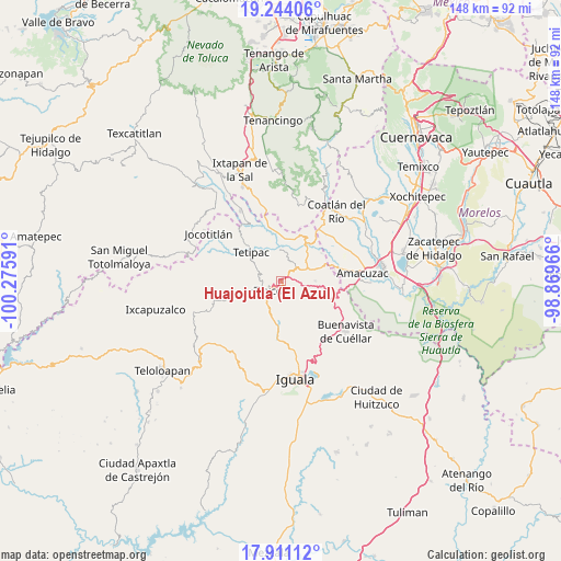
Huajojutla (El Azul) GPS coordinates[2]
18° 34' 44.004" North, 99° 34' 22.008" West
| Map corner | latitude | longitude |
|---|---|---|
| Upper-left | 19.24406°, | -100.27591° |
| Center: | 18.57889°, | -99.57278° |
| Lower-right: | 17.91112°, | -98.86966° |
| Map W x H: | 148.2×148.2 km | = 92.1×92.1mi |
| max Lat: | 32.7° ⇑71.7% North |
| Huajojutla (El Azul): | 18.57889° |
| min Lat: | ⇓28.3% South 14.53588° |
| min Long | Huajojutla (El | max Long |
| -117.105° | -99.57278° | -86.73105° |
| W 42%⇐ | ⇒58% E |
Elevation
Elevation of Huajojutla (El Azul) is 1660 m = 5446 ft, and this is 406.3 m = 1333 ft above average elevation for this country.
| Max E: |
3497 m = 11473 ft | 43% |
| Huajojutla (El Azul) | 1660 m 5446 ft | |
| Avg. | 1253.7 m = 4113 ft | |
Min E: |
-1 m = -3 ft | 57% |
See also: Mexico elevation on elevation.city.
Geographical zone
Huajojutla (El Azul) is located in North Torrid zone (between Equator and Tropic of Cancer). Distance of this Northern Tropic circle is 540.1 km =335.6 mi to North.| Distance of | km | miles | from Huajojutla (El Azul) |
|---|---|---|---|
| North Pole | 7941.3 | 4934.5 | to North |
| Arctic Circle | 5335.4 | 3315.3 | to North |
| Tropic Cancer | 540.1 | 335.6 | to North |
| Equator | 2065.8 | 1283.6 | to South |


Nearby cities:
15 places around Huajojutla (El Azul): (largest is in red/bold)
• Acamixtla
1.7 km =1.1 mi,  154°
154°
• Acuitlapan
4.1 km =2.5 mi,  51°
51°
• Axixintla
6.3 km =3.9 mi,  65°
65°
• Cacalotenango
8.3 km =5.2 mi,  244°
244°
• Chontalcoatlán
8.4 km =5.2 mi,  359°
359°
• Colonia las Martelas
2.2 km =1.4 mi,  223°
223°
• Dolores
8.4 km =5.2 mi,  212°
212°
• El Ejido (Ejido Guerrero)
9 km =5.6 mi,  201°
201°
• Juliantla
4.7 km =2.9 mi,  156°
156°
• San Andrés
8.7 km =5.4 mi,  332°
332°
• San Gregorio
6.1 km =3.8 mi,  338°
338°
• San Juan de Dios (Naranjas de Dios)
3.7 km =2.3 mi, 151°
• Taxco de Alarcón
4.4 km =2.7 mi,  232°
232°
• Tehuilotepec
3.2 km =2 mi, 196°
• Texcaltitla
9.1 km =5.7 mi,  89°
89°
Sources, notices
• [Note1] Compared only with cities in Mexico existing in our database
• [Src1] Map data: © OpenStreetMap contributors (CC-BY-SA)
• [Src2] Other city data from geonames.org with taken over terms of usage.
• [Src3] Geographical zone / Annual Mean Temperature by Robert A. Rohde @ Wikipedia
