Huixtac geodata
Huixtac (Guerrero) is a populated place; located in Mexico in America/Mexico_City (GMT-6) time zone. With population of 840 people, there are 10414 cities with bigger population in this country. Compared to other cities in Mexico, 73% of cities are located further ↑North; 59.6% of cities are located further →East and 54.7% of cities have lower elevation than Huixtac. Note1


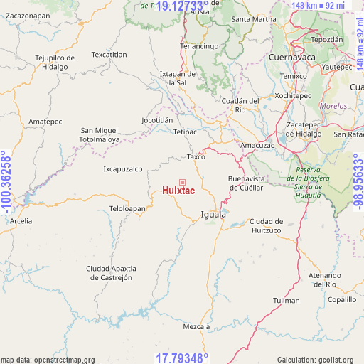
Huixtac GPS coordinates[2]
18° 27' 42.12" North, 99° 39' 34.02" West
| Map corner | latitude | longitude |
|---|---|---|
| Upper-left | 19.12733°, | -100.36258° |
| Center: | 18.4617°, | -99.65945° |
| Lower-right: | 17.79348°, | -98.95633° |
| Map W x H: | 148.3×148.3 km | = 92.1×92.1mi |
| max Lat: | 32.7° ⇑73% North |
| Huixtac: | 18.4617° |
| min Lat: | ⇓27% South 14.53588° |
| min Long | Huixtac | max Long |
| -117.105° | -99.65945° | -86.73105° |
| W 40.4%⇐ | ⇒59.6% E |
Elevation
Elevation of Huixtac is 1581 m = 5187 ft, and this is 327.3 m = 1074 ft above average elevation for this country.
| Max E: |
3497 m = 11473 ft | 45.3% |
| Huixtac | 1581 m 5187 ft | |
| Avg. | 1253.7 m = 4113 ft | |
Min E: |
-1 m = -3 ft | 54.7% |
See also: Mexico elevation on elevation.city.
Geographical zone
Huixtac is located in North Torrid zone (between Equator and Tropic of Cancer). Distance of this Northern Tropic circle is 553.2 km =343.7 mi to North.| Distance of | km | miles | from Huixtac |
|---|---|---|---|
| North Pole | 7954.3 | 4942.6 | to North |
| Arctic Circle | 5348.4 | 3323.3 | to North |
| Tropic Cancer | 553.2 | 343.7 | to North |
| Equator | 2052.7 | 1275.5 | to South |


Nearby cities:
15 places around Huixtac: (largest is in red/bold)
• Ahuehuepan
13.5 km =8.4 mi,  176°
176°
• Atzala
6 km =3.7 mi,  358°
358°
• Cacalotenango
9.6 km =6 mi,  10°
10°
• Colonia las Martelas
13.7 km =8.5 mi,  33°
33°
• Dolores
7.5 km =4.7 mi,  37°
37°
• El Ejido (Ejido Guerrero)
7.5 km =4.7 mi,  51°
51°
• Mexcaltepec
12.9 km =8 mi,  111°
111°
• Paintla
4.6 km =2.9 mi, 5°
• Puente Campuzano
7.6 km =4.7 mi,  99°
99°
• Santiago Temixco
3.2 km =2 mi, 36°
• Taxco de Alarcón
11.8 km =7.3 mi, 28°
• Taxco el Viejo
8.3 km =5.2 mi,  73°
73°
• Tecalpulco
6.7 km =4.2 mi,  63°
63°
• Tehuilotepec
13 km =8.1 mi, 39°
• Temaxcalapa
4.3 km =2.7 mi,  198°
198°
Sources, notices
• [Note1] Compared only with cities in Mexico existing in our database
• [Src1] Map data: © OpenStreetMap contributors (CC-BY-SA)
• [Src2] Other city data from geonames.org with taken over terms of usage.
• [Src3] Geographical zone / Annual Mean Temperature by Robert A. Rohde @ Wikipedia
