Atzacoaloya geodata
Atzacoaloya (Guerrero) is a populated place; located in Mexico in America/Mexico_City (GMT-6) time zone. With population of 2,255 people, there are 3901 cities with bigger population in this country. Compared to other cities in Mexico, 82.7% of cities are located further ↑North; 51.6% of cities are located further →East and 50.1% of cities have higher elevation than Atzacoaloya. Note1


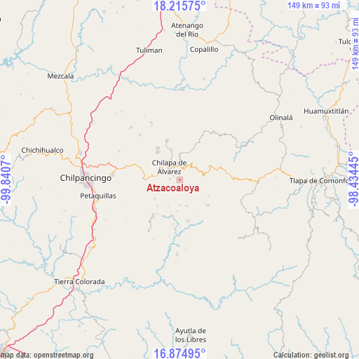
Atzacoaloya GPS coordinates[2]
17° 32' 47.724" North, 99° 8' 15.252" West
| Map corner | latitude | longitude |
|---|---|---|
| Upper-left | 18.21575°, | -99.8407° |
| Center: | 17.54659°, | -99.13757° |
| Lower-right: | 16.87495°, | -98.43445° |
| Map W x H: | 149.1×149.1 km | = 92.6×92.6mi |
| max Lat: | 32.7° ⇑82.7% North |
| Atzacoaloya: | 17.54659° |
| min Lat: | ⇓17.3% South 14.53588° |
| min Long | Atzacoaloya | max Long |
| -117.105° | -99.13757° | -86.73105° |
| W 48.4%⇐ | ⇒51.6% E |
Elevation
Elevation of Atzacoaloya is 1424 m = 4672 ft, and this is 170.3 m = 559 ft above average elevation for this country.
| Max E: |
3497 m = 11473 ft | 50.1% |
| Atzacoaloya | 1424 m 4672 ft | |
| Avg. | 1253.7 m = 4113 ft | |
Min E: |
-1 m = -3 ft | 49.9% |
See also: Mexico elevation on elevation.city.
Geographical zone
Atzacoaloya is located in North Torrid zone (between Equator and Tropic of Cancer). Distance of this Northern Tropic circle is 654.9 km =406.9 mi to North.| Distance of | km | miles | from Atzacoaloya |
|---|---|---|---|
| North Pole | 8056.1 | 5005.8 | to North |
| Arctic Circle | 5450.2 | 3386.6 | to North |
| Tropic Cancer | 654.9 | 406.9 | to North |
| Equator | 1951 | 1212.3 | to South |


Nearby cities:
15 places around Atzacoaloya: (largest is in red/bold)
• Acalco
5.5 km =3.4 mi,  214°
214°
• Agua Zarca
5.4 km =3.4 mi,  351°
351°
• Los Amates
5.9 km =3.7 mi,  269°
269°
• Macuixcatlán
2.8 km =1.7 mi,  304°
304°
• Ocuituco (Acuituco)
5.6 km =3.5 mi,  289°
289°
• San Jerónimo Palantla
5.6 km =3.5 mi,  111°
111°
• Santa Catarina
4 km =2.5 mi, 272°
• Tepetlacingo
2 km =1.2 mi,  332°
332°
• Tlanipatla
1.7 km =1.1 mi, 212°
• Trigomila
4.1 km =2.5 mi,  11°
11°
• Xochitempa
4 km =2.5 mi,  238°
238°
• Zinantla
5.6 km =3.5 mi,  251°
251°
• Zinzintitlán
1.9 km =1.2 mi, 238°
• Zizicazapa
3.8 km =2.4 mi,  204°
204°
• Zoquitipa
4.9 km =3 mi,  258°
258°
Sources, notices
• [Note1] Compared only with cities in Mexico existing in our database
• [Src1] Map data: © OpenStreetMap contributors (CC-BY-SA)
• [Src2] Other city data from geonames.org with taken over terms of usage.
• [Src3] Geographical zone / Annual Mean Temperature by Robert A. Rohde @ Wikipedia
