San Antonio Arrazola geodata
San Antonio Arrazola (Oaxaca) is a populated place; located in Mexico in America/Mexico_City (GMT-6) time zone. With population of 1,113 people, there are 7804 cities with bigger population in this country. Compared to other cities in Mexico, 88.3% of cities are located further ↑North; 77.4% of cities are located further ←West and 56.1% of cities have lower elevation than San Antonio Arrazola. Note1


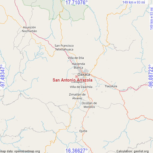
San Antonio Arrazola GPS coordinates[2]
17° 2' 22.992" North, 96° 47' 25.224" West
| Map corner | latitude | longitude |
|---|---|---|
| Upper-left | 17.71076°, | -97.49347° |
| Center: | 17.03972°, | -96.79034° |
| Lower-right: | 16.36627°, | -96.08722° |
| Map W x H: | 149.5×149.5 km | = 92.9×92.9mi |
| max Lat: | 32.7° ⇑88.3% North |
| San Antonio Arrazola: | 17.03972° |
| min Lat: | ⇓11.7% South 14.53588° |
| min Long | San Antonio Arr | max Long |
| -117.105° | -96.79034° | -86.73105° |
| W 77.4%⇐ | ⇒22.6% E |
Elevation
Elevation of San Antonio Arrazola is 1622 m = 5322 ft, and this is 368.3 m = 1208 ft above average elevation for this country.
| Max E: |
3497 m = 11473 ft | 43.9% |
| San Antonio Arrazola | 1622 m 5322 ft | |
| Avg. | 1253.7 m = 4113 ft | |
Min E: |
-1 m = -3 ft | 56.1% |
See also: Mexico elevation on elevation.city.
Geographical zone
San Antonio Arrazola is located in North Torrid zone (between Equator and Tropic of Cancer). Distance of this Northern Tropic circle is 711.3 km =442 mi to North.| Distance of | km | miles | from San Antonio Arrazola |
|---|---|---|---|
| North Pole | 8112.4 | 5040.8 | to North |
| Arctic Circle | 5506.5 | 3421.6 | to North |
| Tropic Cancer | 711.3 | 442 | to North |
| Equator | 1894.6 | 1177.2 | to South |


Nearby cities:
15 places around San Antonio Arrazola: (largest is in red/bold)
• Cruz Blanca
4.2 km =2.6 mi,  130°
130°
• Cuilapan de Guerrero
7 km =4.3 mi,  171°
171°
• El Paraíso
2.1 km =1.3 mi, 132°
• La Cañada
3.6 km =2.2 mi,  21°
21°
• Loma Bonita (Paraje Jagüey)
2.8 km =1.7 mi,  3°
3°
• Lomas de San Juan
4.7 km =2.9 mi,  146°
146°
• Oaxaca
7.6 km =4.7 mi,  68°
68°
• San Andrés Ixtlahuaca
5.2 km =3.2 mi,  312°
312°
• San Francisco Javier
1.8 km =1.1 mi, 132°
• San Isidro Monjas
6.1 km =3.8 mi, 133°
• San Jacinto Amilpas
7.5 km =4.7 mi, 23°
• San Lucas Tlanichico
7.8 km =4.8 mi,  193°
193°
• San Pedro Ixtlahuaca
4 km =2.5 mi, 311°
• Santa Cruz Xoxocotlán
6 km =3.7 mi,  100°
100°
• Santa María Atzompa
7 km =4.3 mi,  11°
11°
Sources, notices
• [Note1] Compared only with cities in Mexico existing in our database
• [Src1] Map data: © OpenStreetMap contributors (CC-BY-SA)
• [Src2] Other city data from geonames.org with taken over terms of usage.
• [Src3] Geographical zone / Annual Mean Temperature by Robert A. Rohde @ Wikipedia
