San Miguel Ameyalco geodata
San Miguel Ameyalco (Morelos) is a populated place; located in Mexico in America/Mexico_City (GMT-6) time zone. With population of 5,387 people, there are 1723 cities with bigger population in this country. Compared to other cities in Mexico, 58.7% of cities are located further ↑North; 56.3% of cities are located further →East and 94.7% of cities have lower elevation than San Miguel Ameyalco. Note1


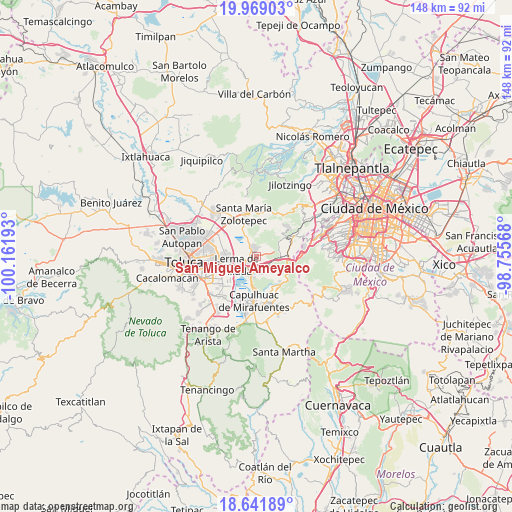
San Miguel Ameyalco GPS coordinates[2]
19° 18' 24.516" North, 99° 27' 31.68" West
| Map corner | latitude | longitude |
|---|---|---|
| Upper-left | 19.96903°, | -100.16193° |
| Center: | 19.30681°, | -99.4588° |
| Lower-right: | 18.64189°, | -98.75568° |
| Map W x H: | 147.6×147.6 km | = 91.7×91.7mi |
| max Lat: | 32.7° ⇑58.7% North |
| San Miguel Ameyalco: | 19.30681° |
| min Lat: | ⇓41.3% South 14.53588° |
| min Long | San Miguel Amey | max Long |
| -117.105° | -99.4588° | -86.73105° |
| W 43.7%⇐ | ⇒56.3% E |
Elevation
Elevation of San Miguel Ameyalco is 2587 m = 8488 ft, and this is 1333.3 m = 4374 ft above average elevation for this country.
| Max E: |
3497 m = 11473 ft | 5.3% |
| San Miguel Ameyalco | 2587 m 8488 ft | |
| Avg. | 1253.7 m = 4113 ft | |
Min E: |
-1 m = -3 ft | 94.7% |
See also: Mexico elevation on elevation.city.
Geographical zone
San Miguel Ameyalco is located in North Torrid zone (between Equator and Tropic of Cancer). Distance of this Northern Tropic circle is 459.2 km =285.3 mi to North.| Distance of | km | miles | from San Miguel Ameyalco |
|---|---|---|---|
| North Pole | 7860.3 | 4884.2 | to North |
| Arctic Circle | 5254.5 | 3265 | to North |
| Tropic Cancer | 459.2 | 285.3 | to North |
| Equator | 2146.7 | 1333.9 | to South |


Nearby cities:
15 places around San Miguel Ameyalco: (largest is in red/bold)
• Amomolulco
3.9 km =2.4 mi,  233°
233°
• Colonia Ejidal Emiliano Zapata
0.8 km =0.5 mi,  165°
165°
• Colonia Juárez
2.5 km =1.6 mi,  198°
198°
• Fraccionamiento y Club de Golf los Encinos
3 km =1.9 mi, 228°
• La Manga (La Laguna)
4.2 km =2.6 mi,  320°
320°
• La Montoya
0.7 km =0.4 mi,  268°
268°
• Loma Bonita
5 km =3.1 mi, 165°
• Loma de los Esquiveles
4.7 km =2.9 mi, 170°
• Nueva Ameyalco
4.9 km =3 mi,  258°
258°
• Ocoyoacac
4 km =2.5 mi,  178°
178°
• Río Hondito
2.7 km =1.7 mi,  131°
131°
• San José el Llanito
2.2 km =1.4 mi, 260°
• San Mateo Atarasquíllo
1.8 km =1.1 mi,  350°
350°
• Santa María Atarasquillo
2.6 km =1.6 mi,  335°
335°
• Santiago Analco
2.8 km =1.7 mi,  14°
14°
Sources, notices
• [Note1] Compared only with cities in Mexico existing in our database
• [Src1] Map data: © OpenStreetMap contributors (CC-BY-SA)
• [Src2] Other city data from geonames.org with taken over terms of usage.
• [Src3] Geographical zone / Annual Mean Temperature by Robert A. Rohde @ Wikipedia
