Nueva Ameyalco geodata
Nueva Ameyalco (State of Mexico) is a populated place; located in Mexico in America/Mexico_City (GMT-6) time zone. With population of 1,002 people, there are 8703 cities with bigger population in this country. Compared to other cities in Mexico, 58.9% of cities are located further ↑North; 57% of cities are located further →East and 94% of cities have lower elevation than Nueva Ameyalco. Note1


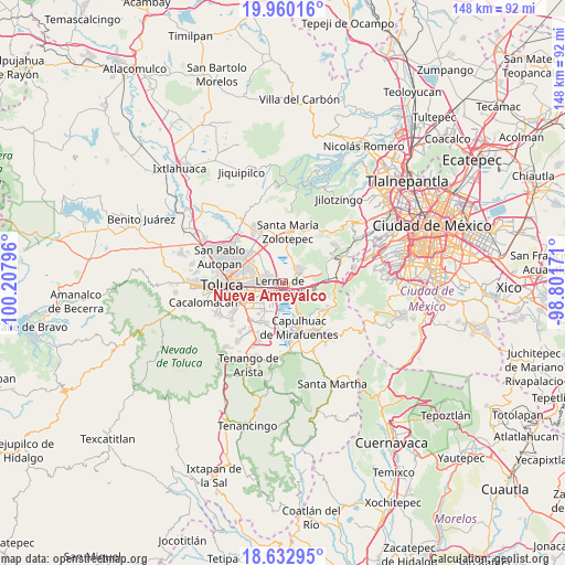
Nueva Ameyalco GPS coordinates[2]
19° 17' 52.44" North, 99° 30' 17.388" West
| Map corner | latitude | longitude |
|---|---|---|
| Upper-left | 19.96016°, | -100.20796° |
| Center: | 19.2979°, | -99.50483° |
| Lower-right: | 18.63295°, | -98.80171° |
| Map W x H: | 147.6×147.6 km | = 91.7×91.7mi |
| max Lat: | 32.7° ⇑58.9% North |
| Nueva Ameyalco: | 19.2979° |
| min Lat: | ⇓41.1% South 14.53588° |
| min Long | Nueva Ameyalco | max Long |
| -117.105° | -99.50483° | -86.73105° |
| W 43%⇐ | ⇒57% E |
Elevation
Elevation of Nueva Ameyalco is 2575 m = 8448 ft, and this is 1321.3 m = 4335 ft above average elevation for this country.
| Max E: |
3497 m = 11473 ft | 6% |
| Nueva Ameyalco | 2575 m 8448 ft | |
| Avg. | 1253.7 m = 4113 ft | |
Min E: |
-1 m = -3 ft | 94% |
See also: Mexico elevation on elevation.city.
Geographical zone
Nueva Ameyalco is located in North Torrid zone (between Equator and Tropic of Cancer). Distance of this Northern Tropic circle is 460.2 km =286 mi to North.| Distance of | km | miles | from Nueva Ameyalco |
|---|---|---|---|
| North Pole | 7861.3 | 4884.8 | to North |
| Arctic Circle | 5255.4 | 3265.6 | to North |
| Tropic Cancer | 460.2 | 286 | to North |
| Equator | 2145.7 | 1333.3 | to South |


Nearby cities:
15 places around Nueva Ameyalco: (largest is in red/bold)
• Amomolulco
2.1 km =1.3 mi,  128°
128°
• Colonia Isidro Fabela
1.9 km =1.2 mi,  278°
278°
• Colonia Juárez
4.3 km =2.7 mi,  108°
108°
• Colonia los Cedros
4.1 km =2.5 mi,  291°
291°
• Fraccionamiento y Club de Golf los Encinos
2.8 km =1.7 mi, 110°
• La Manga (La Laguna)
4.7 km =2.9 mi,  26°
26°
• La Montoya
4.3 km =2.7 mi,  76°
76°
• Lerma de Villada
1.2 km =0.7 mi,  215°
215°
• San Antonio el Llanito
2.5 km =1.6 mi,  155°
155°
• San José el Llanito
2.7 km =1.7 mi, 77°
• San Mateo Atenco
4.4 km =2.7 mi, 220°
• San Miguel Ameyalco
4.9 km =3 mi, 78°
• San Pedro Chochula
4.3 km =2.7 mi,  152°
152°
• San Pedro Cholula
4.2 km =2.6 mi, 152°
• San Pedro Tultepec
3.7 km =2.3 mi,  187°
187°
Sources, notices
• [Note1] Compared only with cities in Mexico existing in our database
• [Src1] Map data: © OpenStreetMap contributors (CC-BY-SA)
• [Src2] Other city data from geonames.org with taken over terms of usage.
• [Src3] Geographical zone / Annual Mean Temperature by Robert A. Rohde @ Wikipedia
