La Manga (La Laguna) geodata
La Manga (La Laguna) (State of Mexico) is a populated place; located in Mexico in America/Mexico_City (GMT-6) time zone. With population of 768 people, there are 11396 cities with bigger population in this country. Compared to other cities in Mexico, 57.9% of cities are located further ↑North; 56.7% of cities are located further →East and 94% of cities have lower elevation than La Manga (La Laguna). Note1


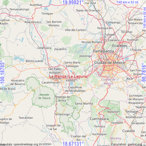
La Manga (La Laguna) GPS coordinates[2]
19° 20' 9.996" North, 99° 29' 4.992" West
| Map corner | latitude | longitude |
|---|---|---|
| Upper-left | 19.99821°, | -100.18785° |
| Center: | 19.33611°, | -99.48472° |
| Lower-right: | 18.67131°, | -98.7816° |
| Map W x H: | 147.5×147.5 km | = 91.7×91.7mi |
| max Lat: | 32.7° ⇑57.9% North |
| La Manga (La Laguna): | 19.33611° |
| min Lat: | ⇓42.1% South 14.53588° |
| min Long | La Manga (La La | max Long |
| -117.105° | -99.48472° | -86.73105° |
| W 43.3%⇐ | ⇒56.7% E |
Elevation
Elevation of La Manga (La Laguna) is 2575 m = 8448 ft, and this is 1321.3 m = 4335 ft above average elevation for this country.
| Max E: |
3497 m = 11473 ft | 6% |
| La Manga (La Laguna) | 2575 m 8448 ft | |
| Avg. | 1253.7 m = 4113 ft | |
Min E: |
-1 m = -3 ft | 94% |
See also: Mexico elevation on elevation.city.
Geographical zone
La Manga (La Laguna) is located in North Torrid zone (between Equator and Tropic of Cancer). Distance of this Northern Tropic circle is 455.9 km =283.3 mi to North.| Distance of | km | miles | from La Manga (La Laguna) |
|---|---|---|---|
| North Pole | 7857.1 | 4882.2 | to North |
| Arctic Circle | 5251.2 | 3262.9 | to North |
| Tropic Cancer | 455.9 | 283.3 | to North |
| Equator | 2150 | 1335.9 | to South |


Nearby cities:
15 places around La Manga (La Laguna): (largest is in red/bold)
• Amomolulco
5.6 km =3.5 mi,  184°
184°
• Arroyo Vista Hermosa
5.5 km =3.4 mi,  263°
263°
• Barranca Grande
5.5 km =3.4 mi,  9°
9°
• Colonia Agrícola Analco
1.8 km =1.1 mi,  33°
33°
• Colonia Ejidal Emiliano Zapata
5 km =3.1 mi,  144°
144°
• Colonia Álvaro Obregón
4.7 km =2.9 mi,  346°
346°
• Fraccionamiento y Club de Golf los Encinos
5.2 km =3.2 mi,  174°
174°
• La Montoya
3.9 km =2.4 mi,  148°
148°
• Nueva Ameyalco
4.7 km =2.9 mi,  206°
206°
• San José el Llanito
3.7 km =2.3 mi, 171°
• San Mateo Atarasquíllo
2.8 km =1.7 mi,  120°
120°
• San Miguel Ameyalco
4.2 km =2.6 mi, 140°
• San Nicolás Peralta
2.6 km =1.6 mi,  358°
358°
• Santa María Atarasquillo
1.9 km =1.2 mi, 117°
• Santiago Analco
3.5 km =2.2 mi,  99°
99°
Sources, notices
• [Note1] Compared only with cities in Mexico existing in our database
• [Src1] Map data: © OpenStreetMap contributors (CC-BY-SA)
• [Src2] Other city data from geonames.org with taken over terms of usage.
• [Src3] Geographical zone / Annual Mean Temperature by Robert A. Rohde @ Wikipedia
