San Mateo Atarasquíllo geodata
San Mateo Atarasquíllo (Morelos) is a populated place; located in Mexico in America/Mexico_City (GMT-6) time zone. With population of 5,273 people, there are 1754 cities with bigger population in this country. Compared to other cities in Mexico, 58.3% of cities are located further ↑North; 56.4% of cities are located further →East and 95.9% of cities have lower elevation than San Mateo Atarasquíllo. Note1


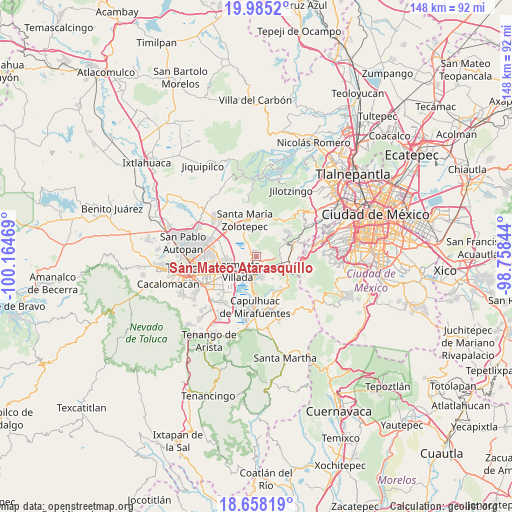
San Mateo Atarasquíllo GPS coordinates[2]
19° 19' 22.944" North, 99° 27' 41.616" West
| Map corner | latitude | longitude |
|---|---|---|
| Upper-left | 19.9852°, | -100.16469° |
| Center: | 19.32304°, | -99.46156° |
| Lower-right: | 18.65819°, | -98.75844° |
| Map W x H: | 147.5×147.6 km | = 91.7×91.7mi |
| max Lat: | 32.7° ⇑58.3% North |
| San Mateo Atarasquíllo: | 19.32304° |
| min Lat: | ⇓41.7% South 14.53588° |
| min Long | San Mateo Atara | max Long |
| -117.105° | -99.46156° | -86.73105° |
| W 43.6%⇐ | ⇒56.4% E |
Elevation
Elevation of San Mateo Atarasquíllo is 2621 m = 8599 ft, and this is 1367.3 m = 4486 ft above average elevation for this country.
| Max E: |
3497 m = 11473 ft | 4.1% |
| San Mateo Atarasquíllo | 2621 m 8599 ft | |
| Avg. | 1253.7 m = 4113 ft | |
Min E: |
-1 m = -3 ft | 95.9% |
See also: Mexico elevation on elevation.city.
Geographical zone
San Mateo Atarasquíllo is located in North Torrid zone (between Equator and Tropic of Cancer). Distance of this Northern Tropic circle is 457.4 km =284.2 mi to North.| Distance of | km | miles | from San Mateo Atarasquíllo |
|---|---|---|---|
| North Pole | 7858.5 | 4883 | to North |
| Arctic Circle | 5252.7 | 3263.9 | to North |
| Tropic Cancer | 457.4 | 284.2 | to North |
| Equator | 2148.5 | 1335 | to South |


Nearby cities:
15 places around San Mateo Atarasquíllo: (largest is in red/bold)
• Amomolulco
5 km =3.1 mi,  214°
214°
• Colonia Agrícola Analco
3.3 km =2.1 mi,  334°
334°
• Colonia Ejidal Emiliano Zapata
2.6 km =1.6 mi,  169°
169°
• Colonia Juárez
4.2 km =2.6 mi,  187°
187°
• Fraccionamiento y Club de Golf los Encinos
4.2 km =2.6 mi, 207°
• La Manga (La Laguna)
2.8 km =1.7 mi,  300°
300°
• La Montoya
1.9 km =1.2 mi, 192°
• Nueva Ameyalco
5.3 km =3.3 mi,  238°
238°
• Río Hondito
4.3 km =2.7 mi,  147°
147°
• San Francisco Xochicuautla
5.8 km =3.6 mi,  17°
17°
• San José el Llanito
2.9 km =1.8 mi,  220°
220°
• San Miguel Ameyalco
1.8 km =1.1 mi, 170°
• San Nicolás Peralta
4.8 km =3 mi, 328°
• Santa María Atarasquillo
1 km =0.6 mi,  306°
306°
• Santiago Analco
1.3 km =0.8 mi,  47°
47°
Sources, notices
• [Note1] Compared only with cities in Mexico existing in our database
• [Src1] Map data: © OpenStreetMap contributors (CC-BY-SA)
• [Src2] Other city data from geonames.org with taken over terms of usage.
• [Src3] Geographical zone / Annual Mean Temperature by Robert A. Rohde @ Wikipedia
