San Lorenzo Acopilco geodata
San Lorenzo Acopilco (Mexico City) is a section of populated place; located in Mexico in America/Mexico_City (GMT-6) time zone. With population of 23,037 people, there are 445 cities with bigger population in this country. Compared to other cities in Mexico, 58.1% of cities are located further ↑North; 54.5% of cities are located further →East and 99.6% of cities have lower elevation than San Lorenzo Acopilco. Note1


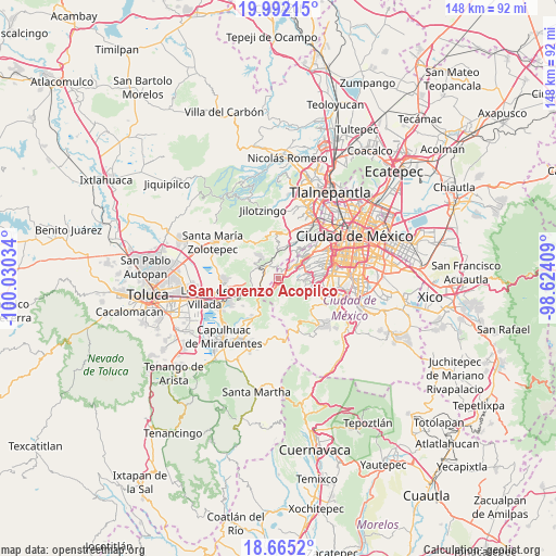
San Lorenzo Acopilco GPS coordinates[2]
19° 19' 48.072" North, 99° 19' 37.956" West
| Map corner | latitude | longitude |
|---|---|---|
| Upper-left | 19.99215°, | -100.03034° |
| Center: | 19.33002°, | -99.32721° |
| Lower-right: | 18.6652°, | -98.62409° |
| Map W x H: | 147.5×147.5 km | = 91.7×91.7mi |
| max Lat: | 32.7° ⇑58.1% North |
| San Lorenzo Acopilco: | 19.33002° |
| min Lat: | ⇓41.9% South 14.53588° |
| min Long | San Lorenzo Aco | max Long |
| -117.105° | -99.32721° | -86.73105° |
| W 45.5%⇐ | ⇒54.5% E |
Elevation
Elevation of San Lorenzo Acopilco is 2935 m = 9629 ft, and this is 1681.3 m = 5516 ft above average elevation for this country.
| Max E: |
3497 m = 11473 ft | 0.40000000000001% |
| San Lorenzo Acopilco | 2935 m 9629 ft | |
| Avg. | 1253.7 m = 4113 ft | |
Min E: |
-1 m = -3 ft | 99.6% |
See also: Mexico elevation on elevation.city.
Geographical zone
San Lorenzo Acopilco is located in North Torrid zone (between Equator and Tropic of Cancer). Distance of this Northern Tropic circle is 456.6 km =283.7 mi to North.| Distance of | km | miles | from San Lorenzo Acopilco |
|---|---|---|---|
| North Pole | 7857.8 | 4882.6 | to North |
| Arctic Circle | 5251.9 | 3263.4 | to North |
| Tropic Cancer | 456.6 | 283.7 | to North |
| Equator | 2149.3 | 1335.5 | to South |


Nearby cities:
15 places around San Lorenzo Acopilco: (largest is in red/bold)
• Barrio de San Ramón
4.9 km =3 mi,  355°
355°
• Colonia La Venta
1.7 km =1.1 mi,  72°
72°
• Cruz Blanca
1.4 km =0.9 mi,  162°
162°
• El Cerrito
3.6 km =2.2 mi,  321°
321°
• El Laurel
4.9 km =3 mi,  305°
305°
• El Mirasol
2.3 km =1.4 mi,  347°
347°
• El Palacio
3.9 km =2.4 mi, 307°
• Huixquilucan
4.1 km =2.5 mi, 324°
• Huixquilucan de Degollado
4.1 km =2.5 mi, 324°
• Ignacio Allende
3.9 km =2.4 mi,  293°
293°
• San Francisco Ayotuzco
5.1 km =3.2 mi, 321°
• San Jacinto
3.7 km =2.3 mi,  6°
6°
• San Juan Yautepec
2.5 km =1.6 mi,  326°
326°
• Santa Rosa
3.4 km =2.1 mi,  102°
102°
• Zacamulpa
2.9 km =1.8 mi, 351°
Sources, notices
• [Note1] Compared only with cities in Mexico existing in our database
• [Src1] Map data: © OpenStreetMap contributors (CC-BY-SA)
• [Src2] Other city data from geonames.org with taken over terms of usage.
• [Src3] Geographical zone / Annual Mean Temperature by Robert A. Rohde @ Wikipedia
