Las Cuevas geodata
Las Cuevas (Oaxaca) is a populated place; located in Mexico in America/Mexico_City (GMT-6) time zone. With population of 614 people, there are 14035 cities with bigger population in this country. Compared to other cities in Mexico, 97.9% of cities are located further ↑North; 79.2% of cities are located further ←West and 74.8% of cities have higher elevation than Las Cuevas. Note1


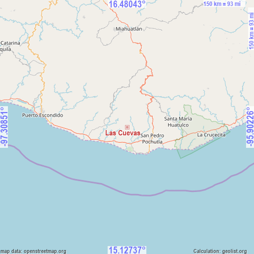
Las Cuevas GPS coordinates[2]
15° 48' 18.108" North, 96° 36' 19.368" West
| Map corner | latitude | longitude |
|---|---|---|
| Upper-left | 16.48043°, | -97.30851° |
| Center: | 15.80503°, | -96.60538° |
| Lower-right: | 15.12737°, | -95.90226° |
| Map W x H: | 150.4×150.4 km | = 93.5×93.5mi |
| max Lat: | 32.7° ⇑97.9% North |
| Las Cuevas: | 15.80503° |
| min Lat: | ⇓2.1% South 14.53588° |
| min Long | Las Cuevas | max Long |
| -117.105° | -96.60538° | -86.73105° |
| W 79.2%⇐ | ⇒20.8% E |
Elevation
Elevation of Las Cuevas is 229 m = 751 ft, and this is 1024.7 m = 3362 ft below average elevation for this country.
| Max E: |
3497 m = 11473 ft | 74.8% |
| Avg. | 1253.7 m = 4113 ft | |
| Las Cuevas | 229 m = 751 ft | |
Min E: |
-1 m = -3 ft | 25.2% |
See also: Mexico elevation on elevation.city.
Geographical zone
Las Cuevas is located in North Torrid zone (between Equator and Tropic of Cancer). Distance of this Northern Tropic circle is 848.6 km =527.3 mi to North.| Distance of | km | miles | from Las Cuevas |
|---|---|---|---|
| North Pole | 8249.7 | 5126.1 | to North |
| Arctic Circle | 5643.8 | 3506.9 | to North |
| Tropic Cancer | 848.6 | 527.3 | to North |
| Equator | 1757.4 | 1092 | to South |


Nearby cities:
15 places around Las Cuevas: (largest is in red/bold)
• Bajos de Santo Domingo
9 km =5.6 mi,  287°
287°
• Barrio Nuevo
6.2 km =3.9 mi,  300°
300°
• Cuatode
12.2 km =7.6 mi,  131°
131°
• El Camalote
7.8 km =4.8 mi,  345°
345°
• Las Pilas
7.8 km =4.8 mi,  262°
262°
• Los Horcones
4.6 km =2.9 mi,  41°
41°
• Macahuitera
3.5 km =2.2 mi,  324°
324°
• Piedra del Sol
7.9 km =4.9 mi,  340°
340°
• Reyes
12.7 km =7.9 mi,  84°
84°
• San Antonio
10.2 km =6.3 mi,  165°
165°
• San Francisco Loxicha
11.3 km =7 mi,  355°
355°
• San Isidro del Palmar
9.5 km =5.9 mi,  182°
182°
• San José Piedras Negras
3.8 km =2.4 mi,  22°
22°
• Santa María Tonameca
8.9 km =5.5 mi,  135°
135°
• Santo Domingo de Morelos
7.3 km =4.5 mi, 296°
Sources, notices
• [Note1] Compared only with cities in Mexico existing in our database
• [Src1] Map data: © OpenStreetMap contributors (CC-BY-SA)
• [Src2] Other city data from geonames.org with taken over terms of usage.
• [Src3] Geographical zone / Annual Mean Temperature by Robert A. Rohde @ Wikipedia
