Sabinillo Ñumí geodata
Sabinillo Ñumí (Oaxaca) is a populated place; located in Mexico in America/Mexico_City (GMT-6) time zone. With population of 538 people, there are 15775 cities with bigger population in this country. Compared to other cities in Mexico, 83.6% of cities are located further ↑North; 66.4% of cities are located further ←West and 90.1% of cities have lower elevation than Sabinillo Ñumí. Note1


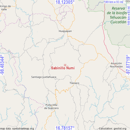
Sabinillo Ñumí GPS coordinates[2]
17° 27' 12.744" North, 97° 46' 49.116" West
| Map corner | latitude | longitude |
|---|---|---|
| Upper-left | 18.12305°, | -98.48344° |
| Center: | 17.45354°, | -97.78031° |
| Lower-right: | 16.78157°, | -97.07719° |
| Map W x H: | 149.2×149.2 km | = 92.7×92.7mi |
| max Lat: | 32.7° ⇑83.6% North |
| Sabinillo Ñumí: | 17.45354° |
| min Lat: | ⇓16.4% South 14.53588° |
| min Long | Sabinillo Ñum� | max Long |
| -117.105° | -97.78031° | -86.73105° |
| W 66.4%⇐ | ⇒33.6% E |
Elevation
Elevation of Sabinillo Ñumí is 2409 m = 7904 ft, and this is 1155.3 m = 3790 ft above average elevation for this country.
| Max E: |
3497 m = 11473 ft | 9.9% |
| Sabinillo Ñumí | 2409 m 7904 ft | |
| Avg. | 1253.7 m = 4113 ft | |
Min E: |
-1 m = -3 ft | 90.1% |
See also: Mexico elevation on elevation.city.
Geographical zone
Sabinillo Ñumí is located in North Torrid zone (between Equator and Tropic of Cancer). Distance of this Northern Tropic circle is 665.3 km =413.4 mi to North.| Distance of | km | miles | from Sabinillo Ñumí |
|---|---|---|---|
| North Pole | 8066.4 | 5012.2 | to North |
| Arctic Circle | 5460.5 | 3393 | to North |
| Tropic Cancer | 665.3 | 413.4 | to North |
| Equator | 1940.7 | 1205.9 | to South |


Nearby cities:
15 places around Sabinillo Ñumí: (largest is in red/bold)
• Guadalupe Monteverde
9.3 km =5.8 mi,  51°
51°
• Peña Colorada
3.1 km =1.9 mi,  331°
331°
• San Antonio Yodonduza Monteverde
7.6 km =4.7 mi,  44°
44°
• San Francisco Caballúa
8 km =5 mi,  58°
58°
• San José Monteverde
7.4 km =4.6 mi, 53°
• San Juan Diquiyu
15 km =9.3 mi, 333°
• San Juan Mixtepec
17.3 km =10.7 mi,  198°
198°
• San Juan Ñumí
10 km =6.2 mi,  128°
128°
• San Miguel Monteverde
8.7 km =5.4 mi,  351°
351°
• San Pedro Mártir Yucuxaco
18.1 km =11.2 mi,  97°
97°
• San Pedro Ñumí
14.5 km =9 mi, 125°
• San Sebastián Nicananduta
12.5 km =7.8 mi, 54°
• Santa María Chilapa de Díaz
12.5 km =7.8 mi, 55°
• Santiago Nundíche
17.7 km =11 mi,  140°
140°
• Santos Reyes Tepejillo
16.9 km =10.5 mi,  264°
264°
Sources, notices
• [Note1] Compared only with cities in Mexico existing in our database
• [Src1] Map data: © OpenStreetMap contributors (CC-BY-SA)
• [Src2] Other city data from geonames.org with taken over terms of usage.
• [Src3] Geographical zone / Annual Mean Temperature by Robert A. Rohde @ Wikipedia
