Guadalupe Monteverde geodata
Guadalupe Monteverde (Oaxaca) is a populated place; located in Mexico in America/Mexico_City (GMT-6) time zone. With population of 712 people, there are 12235 cities with bigger population in this country. Compared to other cities in Mexico, 83.1% of cities are located further ↑North; 67.1% of cities are located further ←West and 89.2% of cities have lower elevation than Guadalupe Monteverde. Note1


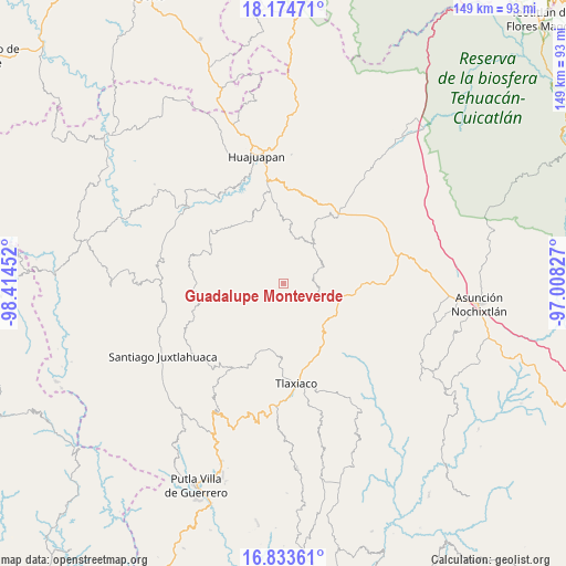
Guadalupe Monteverde GPS coordinates[2]
17° 30' 19.44" North, 97° 42' 41.004" West
| Map corner | latitude | longitude |
|---|---|---|
| Upper-left | 18.17471°, | -98.41452° |
| Center: | 17.5054°, | -97.71139° |
| Lower-right: | 16.83361°, | -97.00827° |
| Map W x H: | 149.1×149.1 km | = 92.6×92.6mi |
| max Lat: | 32.7° ⇑83.1% North |
| Guadalupe Monteverde: | 17.5054° |
| min Lat: | ⇓16.9% South 14.53588° |
| min Long | Guadalupe Monte | max Long |
| -117.105° | -97.71139° | -86.73105° |
| W 67.1%⇐ | ⇒32.9% E |
Elevation
Elevation of Guadalupe Monteverde is 2379 m = 7805 ft, and this is 1125.3 m = 3692 ft above average elevation for this country.
| Max E: |
3497 m = 11473 ft | 10.8% |
| Guadalupe Monteverde | 2379 m 7805 ft | |
| Avg. | 1253.7 m = 4113 ft | |
Min E: |
-1 m = -3 ft | 89.2% |
See also: Mexico elevation on elevation.city.
Geographical zone
Guadalupe Monteverde is located in North Torrid zone (between Equator and Tropic of Cancer). Distance of this Northern Tropic circle is 659.5 km =409.8 mi to North.| Distance of | km | miles | from Guadalupe Monteverde |
|---|---|---|---|
| North Pole | 8060.6 | 5008.6 | to North |
| Arctic Circle | 5454.8 | 3389.5 | to North |
| Tropic Cancer | 659.5 | 409.8 | to North |
| Equator | 1946.4 | 1209.4 | to South |


Nearby cities:
15 places around Guadalupe Monteverde: (largest is in red/bold)
• Peña Colorada
9.3 km =5.8 mi,  250°
250°
• Sabinillo Ñumí
9.3 km =5.8 mi,  231°
231°
• San Antonio Yodonduza Monteverde
2 km =1.2 mi,  259°
259°
• San Francisco Caballúa
1.6 km =1 mi,  197°
197°
• San José Monteverde
1.9 km =1.2 mi, 226°
• San Juan Diquiyu
15.9 km =9.9 mi,  299°
299°
• San Juan Ñumí
12 km =7.5 mi,  177°
177°
• San Miguel Monteverde
9.1 km =5.7 mi,  288°
288°
• San Pedro Mártir Yucuxaco
13.4 km =8.3 mi,  127°
127°
• San Pedro Ñumí
14.9 km =9.3 mi,  162°
162°
• San Sebastián Nicananduta
3.3 km =2.1 mi,  64°
64°
• Santa María Chilapa de Díaz
3.2 km =2 mi,  67°
67°
• Santiago Yolomécatl
15.5 km =9.6 mi,  103°
103°
• Santo Domingo Yodohino
12.8 km =8 mi,  13°
13°
• Tezoatlán de Segura y Luna
19.6 km =12.2 mi,  327°
327°
Sources, notices
• [Note1] Compared only with cities in Mexico existing in our database
• [Src1] Map data: © OpenStreetMap contributors (CC-BY-SA)
• [Src2] Other city data from geonames.org with taken over terms of usage.
• [Src3] Geographical zone / Annual Mean Temperature by Robert A. Rohde @ Wikipedia
