San Sebastián Nicananduta geodata
San Sebastián Nicananduta (Oaxaca) is a seat of a second-order administrative division; located in Mexico in America/Mexico_City (GMT-6) time zone. With population of 1,346 people, there are 6464 cities with bigger population in this country. Compared to other cities in Mexico, 82.9% of cities are located further ↑North; 67.5% of cities are located further ←West and 89.8% of cities have lower elevation than San Sebastián Nicananduta. Note1
Current local time in San Sebastián Nicananduta:
11:28 AM, MondayDifference from your time zone: hours


San Sebastián Nicananduta GPS coordinates[2]
17° 31' 5.808" North, 97° 41' 0.6" West
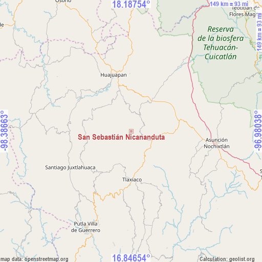
| Map corner | latitude | longitude |
|---|---|---|
| Upper-left | 18.18754°, | -98.38663° |
| Center: | 17.51828°, | -97.6835° |
| Lower-right: | 16.84654°, | -96.98038° |
| Map W x H: | 149.1×149.1 km | = 92.6×92.6mi |
| max Lat: | 32.7° ⇑82.9% North |
| San Sebastián Nicananduta: | 17.51828° |
| min Lat: | ⇓17.1% South 14.53588° |
| min Long | San Sebastián | max Long |
| -117.105° | -97.6835° | -86.73105° |
| W 67.5%⇐ | ⇒32.5% E |
Elevation
Elevation of San Sebastián Nicananduta is 2401 m = 7877 ft, and this is 1147.3 m = 3764 ft above average elevation for this country.
| Max E: |
3497 m = 11473 ft | 10.2% |
| San Sebastián Nicananduta | 2401 m 7877 ft | |
| Avg. | 1253.7 m = 4113 ft | |
Min E: |
-1 m = -3 ft | 89.8% |
See also: Mexico elevation on elevation.city.
Geographical zone
San Sebastián Nicananduta is located in North Torrid zone (between Equator and Tropic of Cancer). Distance of this Northern Tropic circle is 658.1 km =408.9 mi to North.| Distance of | km | miles | from San Sebastián Nicananduta |
|---|---|---|---|
| North Pole | 8059.2 | 5007.8 | to North |
| Arctic Circle | 5453.3 | 3388.5 | to North |
| Tropic Cancer | 658.1 | 408.9 | to North |
| Equator | 1947.9 | 1210.4 | to South |


Nearby cities:
15 places around San Sebastián Nicananduta: (largest is in red/bold)
• Guadalupe Monteverde
3.3 km =2.1 mi,  244°
244°
• Peña Colorada
12.6 km =7.8 mi,  249°
249°
• Sabinillo Ñumí
12.5 km =7.8 mi,  234°
234°
• San Andrés Dinicuiti
19.4 km =12.1 mi,  346°
346°
• San Antonio Yodonduza Monteverde
5.2 km =3.2 mi, 250°
• San Francisco Caballúa
4.6 km =2.9 mi, 229°
• San José Monteverde
5.1 km =3.2 mi, 237°
• San Juan Diquiyu
18 km =11.2 mi,  290°
290°
• San Juan Ñumí
13.7 km =8.5 mi,  190°
190°
• San Miguel Monteverde
11.6 km =7.2 mi,  277°
277°
• San Pedro Mártir Yucuxaco
12.3 km =7.6 mi,  141°
141°
• San Pedro Ñumí
15.8 km =9.8 mi,  174°
174°
• Santa María Chilapa de Díaz
0.2 km =0.1 mi, 174°
• Santiago Yolomécatl
13.1 km =8.1 mi,  112°
112°
• Santo Domingo Yodohino
11 km =6.8 mi,  0°
0°
Sources, notices
• [Note1] Compared only with cities in Mexico existing in our database
• [Src1] Map data: © OpenStreetMap contributors (CC-BY-SA)
• [Src2] Other city data from geonames.org with taken over terms of usage.
• [Src3] Geographical zone / Annual Mean Temperature by Robert A. Rohde @ Wikipedia
