San Sebastián Progreso geodata
San Sebastián Progreso (Oaxaca) is a populated place; located in Mexico in America/Mexico_City (GMT-6) time zone. With population of 550 people, there are 15494 cities with bigger population in this country. Compared to other cities in Mexico, 80.4% of cities are located further ↑North; 67.4% of cities are located further ←West and 65% of cities have lower elevation than San Sebastián Progreso. Note1


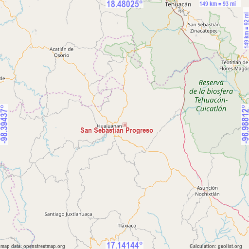
San Sebastián Progreso GPS coordinates[2]
17° 48' 43.56" North, 97° 41' 28.464" West
| Map corner | latitude | longitude |
|---|---|---|
| Upper-left | 18.48025°, | -98.39437° |
| Center: | 17.8121°, | -97.69124° |
| Lower-right: | 17.14144°, | -96.98812° |
| Map W x H: | 148.9×148.9 km | = 92.5×92.5mi |
| max Lat: | 32.7° ⇑80.4% North |
| San Sebastián Progreso: | 17.8121° |
| min Lat: | ⇓19.6% South 14.53588° |
| min Long | San Sebastián | max Long |
| -117.105° | -97.69124° | -86.73105° |
| W 67.4%⇐ | ⇒32.6% E |
Elevation
Elevation of San Sebastián Progreso is 1830 m = 6004 ft, and this is 576.3 m = 1891 ft above average elevation for this country.
| Max E: |
3497 m = 11473 ft | 35% |
| San Sebastián Progreso | 1830 m 6004 ft | |
| Avg. | 1253.7 m = 4113 ft | |
Min E: |
-1 m = -3 ft | 65% |
See also: Mexico elevation on elevation.city.
Geographical zone
San Sebastián Progreso is located in North Torrid zone (between Equator and Tropic of Cancer). Distance of this Northern Tropic circle is 625.4 km =388.6 mi to North.| Distance of | km | miles | from San Sebastián Progreso |
|---|---|---|---|
| North Pole | 8026.5 | 4987.4 | to North |
| Arctic Circle | 5420.7 | 3368.3 | to North |
| Tropic Cancer | 625.4 | 388.6 | to North |
| Equator | 1980.5 | 1230.6 | to South |


Nearby cities:
15 places around San Sebastián Progreso: (largest is in red/bold)
• Acatilma
12.7 km =7.9 mi,  277°
277°
• Asunción Cuyotepeji
13.4 km =8.3 mi,  6°
6°
• Ciudad de Huajuapan de León
9.4 km =5.8 mi,  267°
267°
• Colonia Buena Vista
13.3 km =8.3 mi, 275°
• Corral de Piedra
8.2 km =5.1 mi,  215°
215°
• El Molino
7.6 km =4.7 mi,  237°
237°
• La Estancia
9 km =5.6 mi,  256°
256°
• La Junta
6 km =3.7 mi,  286°
286°
• Los Naranjos [Fraccionamiento]
9.5 km =5.9 mi,  251°
251°
• San Andrés Dinicuiti
14.3 km =8.9 mi,  195°
195°
• San Antonio de León
13.6 km =8.5 mi, 199°
• Santa María Camotlán
9.4 km =5.8 mi,  359°
359°
• Santiago Cacaloxtepec
11.3 km =7 mi,  207°
207°
• Santiago Huajolotitlán
4.7 km =2.9 mi, 291°
• Vista Hermosa
7.2 km =4.5 mi, 255°
Sources, notices
• [Note1] Compared only with cities in Mexico existing in our database
• [Src1] Map data: © OpenStreetMap contributors (CC-BY-SA)
• [Src2] Other city data from geonames.org with taken over terms of usage.
• [Src3] Geographical zone / Annual Mean Temperature by Robert A. Rohde @ Wikipedia
