Río Sapo geodata
Río Sapo (Oaxaca) is a populated place; located in Mexico in America/Mexico_City (GMT-6) time zone. With population of 681 people, there are 12756 cities with bigger population in this country. Compared to other cities in Mexico, 75.3% of cities are located further ↑North; 78.2% of cities are located further ←West and 78.6% of cities have higher elevation than Río Sapo. Note1


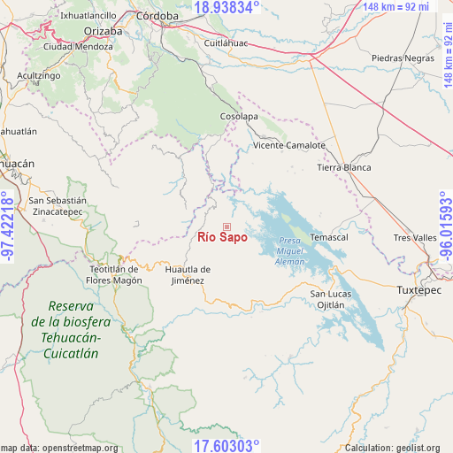
Río Sapo GPS coordinates[2]
18° 16' 19.092" North, 96° 43' 8.58" West
| Map corner | latitude | longitude |
|---|---|---|
| Upper-left | 18.93834°, | -97.42218° |
| Center: | 18.27197°, | -96.71905° |
| Lower-right: | 17.60303°, | -96.01593° |
| Map W x H: | 148.5×148.5 km | = 92.3×92.3mi |
| max Lat: | 32.7° ⇑75.3% North |
| Río Sapo: | 18.27197° |
| min Lat: | ⇓24.7% South 14.53588° |
| min Long | Río Sapo | max Long |
| -117.105° | -96.71905° | -86.73105° |
| W 78.2%⇐ | ⇒21.8% E |
Elevation
Elevation of Río Sapo is 119 m = 390 ft, and this is 1134.7 m = 3723 ft below average elevation for this country.
| Max E: |
3497 m = 11473 ft | 78.6% |
| Avg. | 1253.7 m = 4113 ft | |
| Río Sapo | 119 m = 390 ft | |
Min E: |
-1 m = -3 ft | 21.4% |
See also: Mexico elevation on elevation.city.
Geographical zone
Río Sapo is located in North Torrid zone (between Equator and Tropic of Cancer). Distance of this Northern Tropic circle is 574.3 km =356.9 mi to North.| Distance of | km | miles | from Río Sapo |
|---|---|---|---|
| North Pole | 7975.4 | 4955.7 | to North |
| Arctic Circle | 5369.5 | 3336.5 | to North |
| Tropic Cancer | 574.3 | 356.9 | to North |
| Equator | 2031.7 | 1262.4 | to South |


Nearby cities:
15 places around Río Sapo: (largest is in red/bold)
• Agua de la Rosa
12.7 km =7.9 mi,  197°
197°
• Aguacatitla
9.1 km =5.7 mi,  189°
189°
• Barranca Seca
5 km =3.1 mi,  334°
334°
• Barranca Seca
6.5 km =4 mi,  217°
217°
• Buena Vista de Cuauhtémoc
13.2 km =8.2 mi,  290°
290°
• Buenos Aires
11.1 km =6.9 mi,  98°
98°
• Cerro Clarín
4.7 km =2.9 mi,  86°
86°
• Cerro Palmera
13.3 km =8.3 mi,  170°
170°
• Mazatzongo de Guerrero
12.3 km =7.6 mi,  277°
277°
• Raya Caracol
12.5 km =7.8 mi,  12°
12°
• Río Lodo
4.8 km =3 mi,  54°
54°
• Río Santiago
17.2 km =10.7 mi, 194°
• San Felipe Tílpam
16.8 km =10.4 mi,  123°
123°
• San José Independencia
8.5 km =5.3 mi, 115°
• San José Tenango
13.5 km =8.4 mi,  179°
179°
Sources, notices
• [Note1] Compared only with cities in Mexico existing in our database
• [Src1] Map data: © OpenStreetMap contributors (CC-BY-SA)
• [Src2] Other city data from geonames.org with taken over terms of usage.
• [Src3] Geographical zone / Annual Mean Temperature by Robert A. Rohde @ Wikipedia
