San Felipe Tílpam geodata
San Felipe Tílpam (Oaxaca) is a populated place; located in Mexico in America/Mexico_City (GMT-6) time zone. With population of 1,118 people, there are 7770 cities with bigger population in this country. Compared to other cities in Mexico, 76.4% of cities are located further ↑North; 79.2% of cities are located further ←West and 81.2% of cities have higher elevation than San Felipe Tílpam. Note1


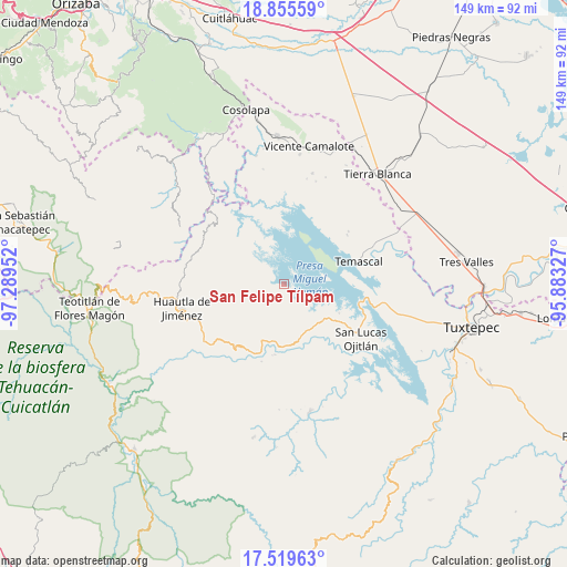
San Felipe Tílpam GPS coordinates[2]
18° 11' 20.004" North, 96° 35' 11.004" West
| Map corner | latitude | longitude |
|---|---|---|
| Upper-left | 18.85559°, | -97.28952° |
| Center: | 18.18889°, | -96.58639° |
| Lower-right: | 17.51963°, | -95.88327° |
| Map W x H: | 148.5×148.5 km | = 92.3×92.3mi |
| max Lat: | 32.7° ⇑76.4% North |
| San Felipe Tílpam: | 18.18889° |
| min Lat: | ⇓23.6% South 14.53588° |
| min Long | San Felipe Tíl | max Long |
| -117.105° | -96.58639° | -86.73105° |
| W 79.2%⇐ | ⇒20.8% E |
Elevation
Elevation of San Felipe Tílpam is 79 m = 259 ft, and this is 1174.7 m = 3854 ft below average elevation for this country.
| Max E: |
3497 m = 11473 ft | 81.2% |
| Avg. | 1253.7 m = 4113 ft | |
| San Felipe Tílpam | 79 m = 259 ft | |
Min E: |
-1 m = -3 ft | 18.8% |
See also: Mexico elevation on elevation.city.
Geographical zone
San Felipe Tílpam is located in North Torrid zone (between Equator and Tropic of Cancer). Distance of this Northern Tropic circle is 583.5 km =362.6 mi to North.| Distance of | km | miles | from San Felipe Tílpam |
|---|---|---|---|
| North Pole | 7984.6 | 4961.4 | to North |
| Arctic Circle | 5378.8 | 3342.2 | to North |
| Tropic Cancer | 583.5 | 362.6 | to North |
| Equator | 2022.4 | 1256.7 | to South |


Nearby cities:
15 places around San Felipe Tílpam: (largest is in red/bold)
• Arroyo Murciélago
6.3 km =3.9 mi,  139°
139°
• Arroyo Zapotillo
13.3 km =8.3 mi,  160°
160°
• Buenos Aires
8.2 km =5.1 mi,  338°
338°
• Camino de Ixcatlán
11.9 km =7.4 mi, 144°
• Cerro Clarín
13.4 km =8.3 mi,  315°
315°
• Cerro Palmera
12.5 km =7.8 mi,  251°
251°
• Cerro Quemado
4 km =2.5 mi, 162°
• Colonia la Central
13.6 km =8.5 mi,  146°
146°
• El Progreso
8.2 km =5.1 mi, 148°
• Isla Soyaltepec
11 km =6.8 mi,  82°
82°
• Loma San Juan
10.8 km =6.7 mi, 155°
• Los Zarates
12 km =7.5 mi, 139°
• San José Independencia
8.4 km =5.2 mi,  311°
311°
• San Pedro Ixcatlán
9.4 km =5.8 mi,  120°
120°
• Sección los Roques
12.8 km =8 mi, 137°
Sources, notices
• [Note1] Compared only with cities in Mexico existing in our database
• [Src1] Map data: © OpenStreetMap contributors (CC-BY-SA)
• [Src2] Other city data from geonames.org with taken over terms of usage.
• [Src3] Geographical zone / Annual Mean Temperature by Robert A. Rohde @ Wikipedia
