Cerro Palmera geodata
Cerro Palmera (Oaxaca) is a populated place; located in Mexico in America/Mexico_City (GMT-6) time zone. With population of 510 people, there are 16480 cities with bigger population in this country. Compared to other cities in Mexico, 76.8% of cities are located further ↑North; 78.4% of cities are located further ←West and 61.4% of cities have higher elevation than Cerro Palmera. Note1


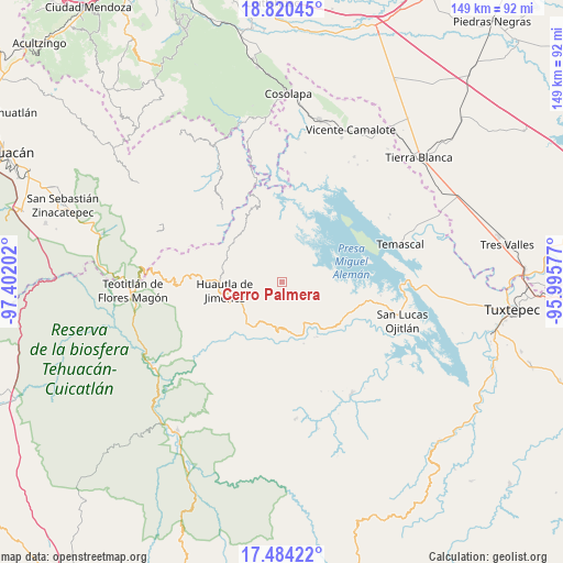
Cerro Palmera GPS coordinates[2]
18° 9' 12.996" North, 96° 41' 56.004" West
| Map corner | latitude | longitude |
|---|---|---|
| Upper-left | 18.82045°, | -97.40202° |
| Center: | 18.15361°, | -96.69889° |
| Lower-right: | 17.48422°, | -95.99577° |
| Map W x H: | 148.6×148.6 km | = 92.3×92.3mi |
| max Lat: | 32.7° ⇑76.8% North |
| Cerro Palmera: | 18.15361° |
| min Lat: | ⇓23.2% South 14.53588° |
| min Long | Cerro Palmera | max Long |
| -117.105° | -96.69889° | -86.73105° |
| W 78.4%⇐ | ⇒21.6% E |
Elevation
Elevation of Cerro Palmera is 915 m = 3002 ft, and this is 338.7 m = 1111 ft below average elevation for this country.
| Max E: |
3497 m = 11473 ft | 61.4% |
| Avg. | 1253.7 m = 4113 ft | |
| Cerro Palmera | 915 m = 3002 ft | |
Min E: |
-1 m = -3 ft | 38.6% |
See also: Mexico elevation on elevation.city.
Geographical zone
Cerro Palmera is located in North Torrid zone (between Equator and Tropic of Cancer). Distance of this Northern Tropic circle is 587.4 km =365 mi to North.| Distance of | km | miles | from Cerro Palmera |
|---|---|---|---|
| North Pole | 7988.6 | 4963.9 | to North |
| Arctic Circle | 5382.7 | 3344.7 | to North |
| Tropic Cancer | 587.4 | 365 | to North |
| Equator | 2018.5 | 1254.2 | to South |


Nearby cities:
15 places around Cerro Palmera: (largest is in red/bold)
• Agua de la Rosa
6.1 km =3.8 mi,  280°
280°
• Aguacatitla
5.5 km =3.4 mi,  319°
319°
• Barranca Seca
10.1 km =6.3 mi, 322°
• Cerro Quemado
13.1 km =8.1 mi,  89°
89°
• Huautepec
11.8 km =7.3 mi,  240°
240°
• La Soledad Piedra Ancha
12.1 km =7.5 mi,  182°
182°
• Llano de Agua
13 km =8.1 mi,  245°
245°
• Loma Chilar
13.6 km =8.5 mi,  264°
264°
• Río Santiago
7.4 km =4.6 mi, 242°
• Río Sapo
13.3 km =8.3 mi,  350°
350°
• San Andrés Hidalgo
11.5 km =7.1 mi, 260°
• San Felipe Tílpam
12.5 km =7.8 mi,  71°
71°
• San José Independencia
11 km =6.8 mi,  30°
30°
• San José Tenango
2 km =1.2 mi, 261°
• San Juan Coatzospam
13.4 km =8.3 mi,  210°
210°
Sources, notices
• [Note1] Compared only with cities in Mexico existing in our database
• [Src1] Map data: © OpenStreetMap contributors (CC-BY-SA)
• [Src2] Other city data from geonames.org with taken over terms of usage.
• [Src3] Geographical zone / Annual Mean Temperature by Robert A. Rohde @ Wikipedia
