La Soledad geodata
La Soledad (Oaxaca) is a populated place; located in Mexico in America/Mexico_City (GMT-6) time zone. With population of 809 people, there are 10801 cities with bigger population in this country. Compared to other cities in Mexico, 80% of cities are located further ↑North; 82.5% of cities are located further ←West and 83.1% of cities have higher elevation than La Soledad. Note1


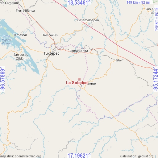
La Soledad GPS coordinates[2]
17° 52' 0.012" North, 95° 52' 32.016" West
| Map corner | latitude | longitude |
|---|---|---|
| Upper-left | 18.53461°, | -96.57869° |
| Center: | 17.86667°, | -95.87556° |
| Lower-right: | 17.19621°, | -95.17244° |
| Map W x H: | 148.8×148.8 km | = 92.5×92.5mi |
| max Lat: | 32.7° ⇑80% North |
| La Soledad: | 17.86667° |
| min Lat: | ⇓20% South 14.53588° |
| min Long | La Soledad | max Long |
| -117.105° | -95.87556° | -86.73105° |
| W 82.5%⇐ | ⇒17.5% E |
Elevation
Elevation of La Soledad is 59 m = 194 ft, and this is 1194.7 m = 3920 ft below average elevation for this country.
| Max E: |
3497 m = 11473 ft | 83.1% |
| Avg. | 1253.7 m = 4113 ft | |
| La Soledad | 59 m = 194 ft | |
Min E: |
-1 m = -3 ft | 16.9% |
See also: Mexico elevation on elevation.city.
Geographical zone
La Soledad is located in North Torrid zone (between Equator and Tropic of Cancer). Distance of this Northern Tropic circle is 619.3 km =384.8 mi to North.| Distance of | km | miles | from La Soledad |
|---|---|---|---|
| North Pole | 8020.5 | 4983.7 | to North |
| Arctic Circle | 5414.6 | 3364.5 | to North |
| Tropic Cancer | 619.3 | 384.8 | to North |
| Equator | 1986.6 | 1234.4 | to South |


Nearby cities:
15 places around La Soledad: (largest is in red/bold)
• Arenal Santa Ana
14.1 km =8.8 mi,  127°
127°
• Arroyo Limón
9.8 km =6.1 mi,  292°
292°
• Arroyo Metate
16.6 km =10.3 mi,  339°
339°
• Bethania
14.9 km =9.3 mi, 293°
• Chilapa del Carmen
11.9 km =7.4 mi,  141°
141°
• El Nigromante
16.9 km =10.5 mi, 132°
• Esperanza Arroyo la Gloria
15.2 km =9.4 mi,  315°
315°
• La Carlota
2.7 km =1.7 mi,  180°
180°
• La Victoria
12.7 km =7.9 mi,  81°
81°
• Mixtán
5.2 km =3.2 mi,  18°
18°
• Playa Vicente
7.8 km =4.8 mi,  120°
120°
• Pueblo Nuevo Ojo de Agua
5.4 km =3.4 mi,  303°
303°
• San Benito Encinal
13.9 km =8.6 mi, 344°
• San Felipe
6.6 km =4.1 mi,  243°
243°
• Tomate Río Manso
14.8 km =9.2 mi, 178°
Sources, notices
• [Note1] Compared only with cities in Mexico existing in our database
• [Src1] Map data: © OpenStreetMap contributors (CC-BY-SA)
• [Src2] Other city data from geonames.org with taken over terms of usage.
• [Src3] Geographical zone / Annual Mean Temperature by Robert A. Rohde @ Wikipedia
