San Pedro Coyaltepec geodata
San Pedro Coyaltepec (Oaxaca) is a populated place; located in Mexico in America/Mexico_City (GMT-6) time zone. With population of 665 people, there are 13061 cities with bigger population in this country. Compared to other cities in Mexico, 80.8% of cities are located further ↑North; 77.4% of cities are located further ←West and 77.4% of cities have lower elevation than San Pedro Coyaltepec. Note1


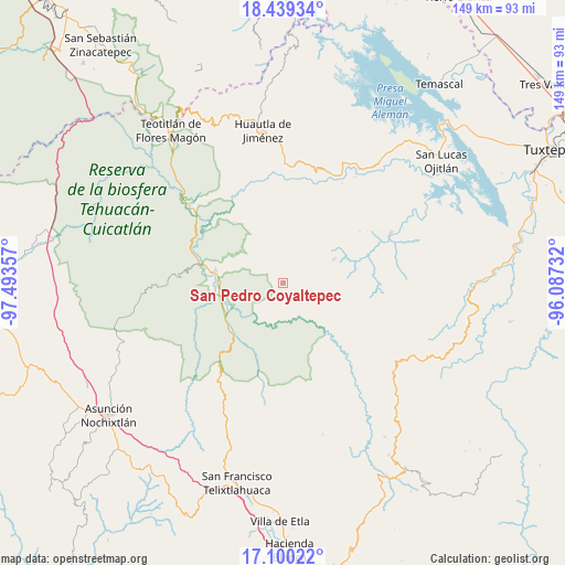
San Pedro Coyaltepec GPS coordinates[2]
17° 46' 15.708" North, 96° 47' 25.584" West
| Map corner | latitude | longitude |
|---|---|---|
| Upper-left | 18.43934°, | -97.49357° |
| Center: | 17.77103°, | -96.79044° |
| Lower-right: | 17.10022°, | -96.08732° |
| Map W x H: | 148.9×148.9 km | = 92.5×92.5mi |
| max Lat: | 32.7° ⇑80.8% North |
| San Pedro Coyaltepec: | 17.77103° |
| min Lat: | ⇓19.2% South 14.53588° |
| min Long | San Pedro Coyal | max Long |
| -117.105° | -96.79044° | -86.73105° |
| W 77.4%⇐ | ⇒22.6% E |
Elevation
Elevation of San Pedro Coyaltepec is 2074 m = 6804 ft, and this is 820.3 m = 2691 ft above average elevation for this country.
| Max E: |
3497 m = 11473 ft | 22.6% |
| San Pedro Coyaltepec | 2074 m 6804 ft | |
| Avg. | 1253.7 m = 4113 ft | |
Min E: |
-1 m = -3 ft | 77.4% |
See also: Mexico elevation on elevation.city.
Geographical zone
San Pedro Coyaltepec is located in North Torrid zone (between Equator and Tropic of Cancer). Distance of this Northern Tropic circle is 630 km =391.5 mi to North.| Distance of | km | miles | from San Pedro Coyaltepec |
|---|---|---|---|
| North Pole | 8031.1 | 4990.3 | to North |
| Arctic Circle | 5425.2 | 3371.1 | to North |
| Tropic Cancer | 630 | 391.5 | to North |
| Equator | 1976 | 1227.8 | to South |


Nearby cities:
15 places around San Pedro Coyaltepec: (largest is in red/bold)
• Concepción Pápalo
12.5 km =7.8 mi,  309°
309°
• Cuicatlan
18.2 km =11.3 mi,  281°
281°
• San Alejo el Progreso
14.7 km =9.1 mi,  28°
28°
• San Francisco Tutepetongo
11.4 km =7.1 mi,  237°
237°
• San José del Chilar
16.9 km =10.5 mi,  246°
246°
• San Juan Sautla
15.6 km =9.7 mi,  51°
51°
• San Juan Teponaxtla
9.4 km =5.8 mi,  128°
128°
• San Lorenzo Pápalo
15.8 km =9.8 mi,  323°
323°
• San Miguel Santa Flor
16.7 km =10.4 mi,  356°
356°
• San Pedro Chicozapotes
17.8 km =11.1 mi,  269°
269°
• San Pedro Sochiápam
14.9 km =9.3 mi,  64°
64°
• Santa María Pápalo
1.7 km =1.1 mi,  334°
334°
• Santiago Quetzalapa
18.3 km =11.4 mi,  66°
66°
• Santos Reyes Pápalo
8.4 km =5.2 mi,  296°
296°
• Tomellín
18.1 km =11.2 mi, 265°
Sources, notices
• [Note1] Compared only with cities in Mexico existing in our database
• [Src1] Map data: © OpenStreetMap contributors (CC-BY-SA)
• [Src2] Other city data from geonames.org with taken over terms of usage.
• [Src3] Geographical zone / Annual Mean Temperature by Robert A. Rohde @ Wikipedia
