Cuicatlan geodata
Cuicatlan (Oaxaca) is a populated place; located in Mexico in America/Mexico_City (GMT-6) time zone. With population of 3,908 people, there are 2340 cities with bigger population in this country. Compared to other cities in Mexico, 80.5% of cities are located further ↑North; 75.4% of cities are located further ←West and 65.3% of cities have higher elevation than Cuicatlan. Note1


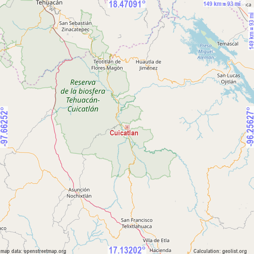
Cuicatlan GPS coordinates[2]
17° 48' 9.792" North, 96° 57' 33.804" West
| Map corner | latitude | longitude |
|---|---|---|
| Upper-left | 18.47091°, | -97.66252° |
| Center: | 17.80272°, | -96.95939° |
| Lower-right: | 17.13202°, | -96.25627° |
| Map W x H: | 148.9×148.9 km | = 92.5×92.5mi |
| max Lat: | 32.7° ⇑80.5% North |
| Cuicatlan: | 17.80272° |
| min Lat: | ⇓19.5% South 14.53588° |
| min Long | Cuicatlan | max Long |
| -117.105° | -96.95939° | -86.73105° |
| W 75.4%⇐ | ⇒24.6% E |
Elevation
Elevation of Cuicatlan is 668 m = 2192 ft, and this is 585.7 m = 1922 ft below average elevation for this country.
| Max E: |
3497 m = 11473 ft | 65.3% |
| Avg. | 1253.7 m = 4113 ft | |
| Cuicatlan | 668 m = 2192 ft | |
Min E: |
-1 m = -3 ft | 34.7% |
See also: Mexico elevation on elevation.city.
Geographical zone
Cuicatlan is located in North Torrid zone (between Equator and Tropic of Cancer). Distance of this Northern Tropic circle is 626.4 km =389.2 mi to North.| Distance of | km | miles | from Cuicatlan |
|---|---|---|---|
| North Pole | 8027.6 | 4988.1 | to North |
| Arctic Circle | 5421.7 | 3368.9 | to North |
| Tropic Cancer | 626.4 | 389.2 | to North |
| Equator | 1979.5 | 1230 | to South |


Nearby cities:
15 places around Cuicatlan: (largest is in red/bold)
• Concepción Pápalo
9.3 km =5.8 mi,  61°
61°
• Jaltepetongo
15.3 km =9.5 mi,  211°
211°
• San Francisco Tutepetongo
12.7 km =7.9 mi,  139°
139°
• San José del Chilar
10.4 km =6.5 mi,  166°
166°
• San Juan Coyula
13.5 km =8.4 mi,  22°
22°
• San Lorenzo Pápalo
12.4 km =7.7 mi,  42°
42°
• San Pedro Chicozapotes
3.8 km =2.4 mi,  178°
178°
• San Pedro Coyaltepec
18.2 km =11.3 mi,  101°
101°
• San Pedro Jocotipac
13.2 km =8.2 mi,  253°
253°
• Santa María Pápalo
17.3 km =10.7 mi, 96°
• Santos Reyes Pápalo
10.4 km =6.5 mi,  88°
88°
• Tecomavaca
18.3 km =11.4 mi,  338°
338°
• Texcatitlán
15.1 km =9.4 mi,  228°
228°
• Tomellín
4.8 km =3 mi, 181°
• Valerio Trujano
4 km =2.5 mi, 213°
Sources, notices
• [Note1] Compared only with cities in Mexico existing in our database
• [Src1] Map data: © OpenStreetMap contributors (CC-BY-SA)
• [Src2] Other city data from geonames.org with taken over terms of usage.
• [Src3] Geographical zone / Annual Mean Temperature by Robert A. Rohde @ Wikipedia
